Cof Cymru: National Historic Assets of Wales · Wales
Outbuilding some 30m NE of large barn at Llanerchaeron
Ciliau Aeron, Ceredigion, Wales
A Grade II listed building in Llanerchaeron, Ciliau Aeron, Ceredigion, designated on 15 November 1990.
The record
- Designation
- Listed building, Grade II
- Broad class
- Agriculture and Subsistence
- Date of designation
- 15 November 1990
- Locality
- Llanerchaeron
- Community
- Ciliau Aeron
- Unitary authority
- Ceredigion
- Country
- Wales
- Coordinates
- 52.21885, -4.22448
- Cadw reference
- 10726
Slide toward Today to fade the historical sheet and see the modern map underneath.
David Rumsey Map Collection, Stanford LibrariesDavid Rumsey Map Collection, Stanford LibrariesDavid Rumsey Map Collection, Stanford LibrariesDavid Rumsey Map Collection, Stanford LibrariesDavid Rumsey Map Collection, Stanford Libraries
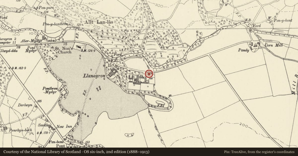
5 historical maps cover this location, the earliest the 1608 map "(13) Cambriae Typus." (David Rumsey Map Collection, Stanford Libraries).
Historical maps covering this location
- 1608 · (13) Cambriae Typus. (David Rumsey Map Collection, Stanford Libraries)
- 1830 · V.3:11-15:XV. Britisches Reich. A. Kon: England. b. Frstenthum Wales: Shire: 37-40 (David Rumsey Map Collection, Stanford Libraries)
- 1848 · 57. Tregaron, SW Quad. (David Rumsey Map Collection, Stanford Libraries)
- 1901 · Sheet 14. (David Rumsey Map Collection, Stanford Libraries)
- 1919 · Sheet 78. Lampeter. (David Rumsey Map Collection, Stanford Libraries)
Cadw's description
Location
Situated between large barn and by-road.
History
Mid/late C19, said to be the former saw mill (saw-pit now infilled).
Exterior
Single storey. Open front with single long eaves beam of some 7-8m length. Square rubble built pier to each corner, rounded on inner face. Rubble rear wall. Slate roof. Wide opening to each end.
Interior
Four-bay collar-truss roof, curved pegged collars and tenoned apexes.
In poor condition (summer 1995).
Reason for designation
Included for group value as part of complete surviving estate farm at Llanerchaeron.
Nearby in the register
- Carpenter's Shop at Llanerchaeron (previously listed as sited at Llanaeron Home Farm)Commercialunder 1 mi
- Wheel-Pit and Water-Wheel at Llanerchaeron (Previously listed as sited at Llanaeron)Agriculture and Subsistenceunder 1 mi
- Barn at Llanerchaeron (Previously lised as sited at Llanaeron Home Farm)Agriculture and Subsistenceunder 1 mi
- Granary at Llanerchaeron (Previously listed as sited at Llanaeron Home Farm)Agriculture and Subsistenceunder 1 mi
Other entries of the same register within about three miles of this one, by straight line.