Cof Cymru: National Historic Assets of Wales · Wales
Gatepiers and gates at Hafod Lower Lodge
Ysbyty Ystwyth, Ceredigion, Wales
A Grade II listed building in Pontrhydygroes, Ystrad Meurig, Ysbyty Ystwyth, Ceredigion, designated on 24 August 1989.
The record
- Designation
- Listed building, Grade II
- Broad class
- Domestic
- Date of designation
- 24 August 1989
- Locality
- Pontrhydygroes
- Town
- Ystrad Meurig
- Community
- Ysbyty Ystwyth
- Unitary authority
- Ceredigion
- Country
- Wales
- Coordinates
- 52.33895, -3.84700
- Cadw reference
- 10709
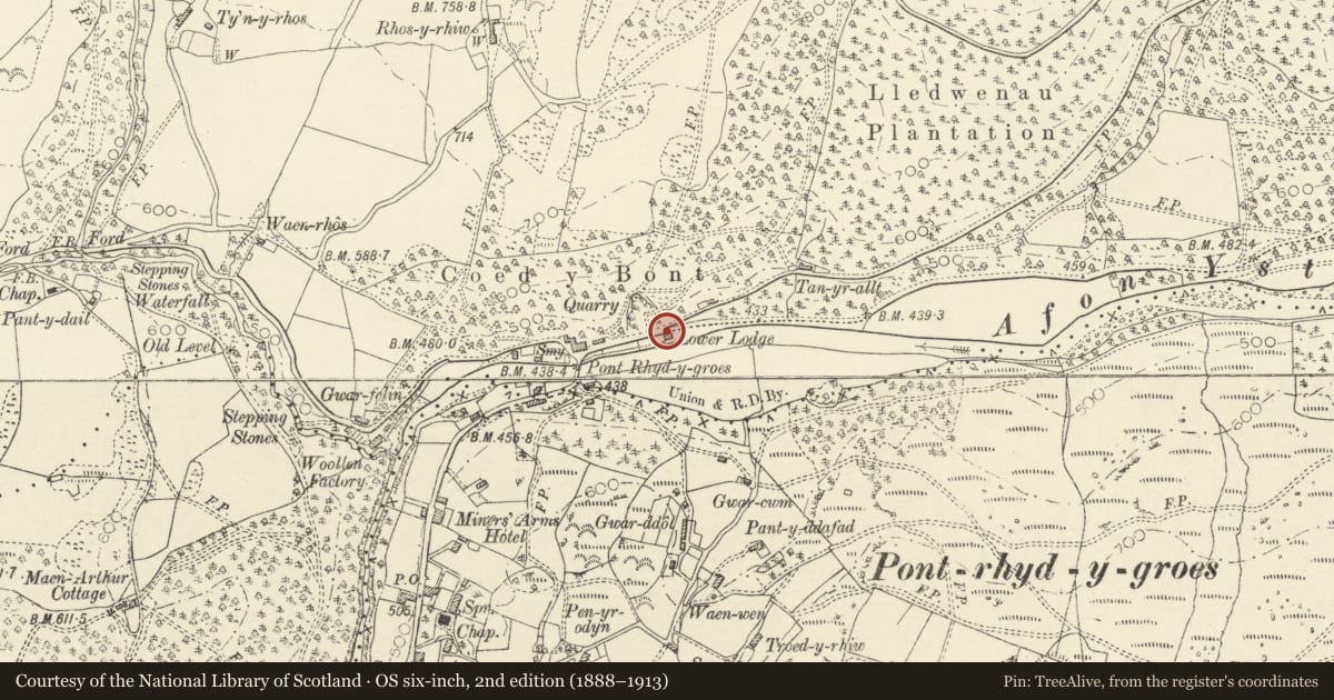
Slide toward Today to fade the historical sheet and see the modern map underneath.
David Rumsey Map Collection, Stanford LibrariesDavid Rumsey Map Collection, Stanford LibrariesDavid Rumsey Map Collection, Stanford LibrariesDavid Rumsey Map Collection, Stanford LibrariesDavid Rumsey Map Collection, Stanford Libraries
5 historical maps cover this location, the earliest the 1608 map "(13) Cambriae Typus." (David Rumsey Map Collection, Stanford Libraries).
Historical maps covering this location
- 1608 · (13) Cambriae Typus. (David Rumsey Map Collection, Stanford Libraries)
- 1830 · V.3:11-15:XV. Britisches Reich. A. Kon: England. b. Frstenthum Wales: Shire: 37-40 (David Rumsey Map Collection, Stanford Libraries)
- 1883 · Watershed map England, Wales 3. (David Rumsey Map Collection, Stanford Libraries)
- 1899 · 178 Llanilar (Hills) (David Rumsey Map Collection, Stanford Libraries)
- 1901 · Sheet 14. (David Rumsey Map Collection, Stanford Libraries)
Cadw's description
Location
Situated immediately beside the lodge, E of bridge over Ystwyth.
History
Pair of later C19 gatepiers to Hafod, presumably dating from ownership of John Waddingham after 1872. The gates themselves are in poor condition and dismantled (2004).
Exterior
Pair of widely-separated square rubble stone piers with broad rusticated ashlar quoins, cornices and stepped pyramidal caps. There were in 1989 iron gates in poor condition, a pedestrian gate attached to the S pier, the main gate detached. Both detached 2004. A square cast-iron pier between main gate and pedestrian gate remains, partly broken.
Reason for designation
Included as pair of stone gatepiers and iron gates of group value with the lodge.
Nearby in the register
- Hafod Lower LodgeDomesticunder 1 mi
- Hafod HouseDomesticunder 1 mi
- Ystwyth VillaDomesticunder 1 mi
- Outbuilding at Ystwyth VillaAgriculture and Subsistenceunder 1 mi
Other entries of the same register within about three miles of this one, by straight line.