Cof Cymru: National Historic Assets of Wales · Wales
Trefelin
Tregaron, Ceredigion, Wales
A Grade II listed building in Tregaron, Ceredigion, designated on 4 November 1977.
The record
- Designation
- Listed building, Grade II
- Broad class
- Domestic
- Date of designation
- 4 November 1977
- Locality
- Tregaron
- Town
- Tregaron
- Community
- Tregaron
- Unitary authority
- Ceredigion
- Country
- Wales
- Coordinates
- 52.22034, -3.93511
- Cadw reference
- 10691
Slide toward Today to fade the historical sheet and see the modern map underneath.
David Rumsey Map Collection, Stanford LibrariesDavid Rumsey Map Collection, Stanford LibrariesDavid Rumsey Map Collection, Stanford LibrariesDavid Rumsey Map Collection, Stanford LibrariesDavid Rumsey Map Collection, Stanford Libraries
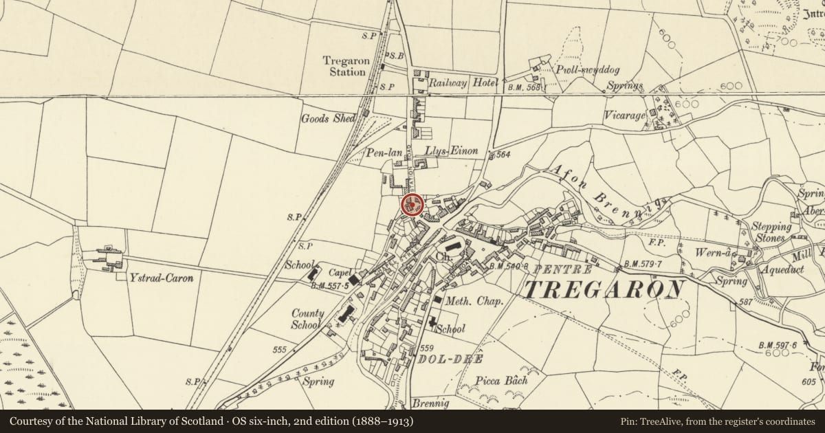
5 historical maps cover this location, the earliest the 1608 map "(13) Cambriae Typus." (David Rumsey Map Collection, Stanford Libraries).
Historical maps covering this location
- 1608 · (13) Cambriae Typus. (David Rumsey Map Collection, Stanford Libraries)
- 1830 · V.3:11-15:XV. Britisches Reich. A. Kon: England. b. Frstenthum Wales: Shire: 37-40 (David Rumsey Map Collection, Stanford Libraries)
- 1883 · Watershed map England, Wales 3. (David Rumsey Map Collection, Stanford Libraries)
- 1899 · 178 Llanilar (Hills) (David Rumsey Map Collection, Stanford Libraries)
- 1901 · Sheet 14. (David Rumsey Map Collection, Stanford Libraries)
Cadw's description
Location
Situated W of centre of Tregaron, on corner of Station Road and back lane to Bwlchgwynt Chapel. Stone cobbled pavement in front, cobbled yard behind.
History
Mid C18 house, said to have been an inn in C19.
Exterior
Whitewashed rubble stone with slate roof and stone end stacks. Two-storey, asymmetric four-window E front with horizontally-sliding small-paned casement windows in three bays and door only in second from left. Stone slab lintels to ground floor openings. 4-panel C19 door. Ground floor left window was once a door. S end wall has one small ground floor window adjoining fireplace. N end wall is built into bank. Rear has one small casement under eaves, and ground floor window, door and window.
Interior
Large S end fireplace with timber lintel. Exposed ceiling beams and joists, one beam with a stop. Entrance passage with C19 panelled partitions and 6-panel doors. Later C19 N end fireplace. C19 stick-baluster stair.
Reason for designation
Listed as a rare survivor of the pre C19 houses of the town, still with the small upper windows typical of the Georgian period.
Nearby in the register
- National Westminster BankCommercialunder 1 mi
- Church of Saint CaronReligious, Ritual and Funeraryunder 1 mi
- Henry Richard MemorialCommemorativeunder 1 mi
- Telephone Call Box by the Memorial Hall (01974 298233)Communicationsunder 1 mi
Other entries of the same register within about three miles of this one, by straight line.