Cof Cymru: National Historic Assets of Wales · Wales
L-Plan Outbuilding at SW angle of farmyard at Cefn Gwyddil Farm
Llanllwchaiarn, Ceredigion, Wales
A Grade II listed building in Cross Inn, Llanllwchaiarn, Ceredigion, designated on 25 February 1993.
The record
- Designation
- Listed building, Grade II
- Broad class
- Agriculture and Subsistence
- Date of designation
- 25 February 1993
- Locality
- Cross Inn
- Community
- Llanllwchaiarn
- Unitary authority
- Ceredigion
- Country
- Wales
- Coordinates
- 52.19397, -4.35850
- Cadw reference
- 10673
Slide toward Today to fade the historical sheet and see the modern map underneath.
David Rumsey Map Collection, Stanford LibrariesDavid Rumsey Map Collection, Stanford LibrariesDavid Rumsey Map Collection, Stanford LibrariesDavid Rumsey Map Collection, Stanford LibrariesDavid Rumsey Map Collection, Stanford Libraries
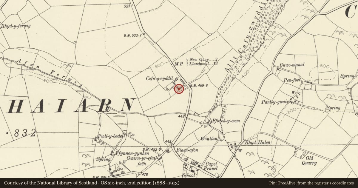
5 historical maps cover this location, the earliest the 1608 map "(13) Cambriae Typus." (David Rumsey Map Collection, Stanford Libraries).
Historical maps covering this location
- 1608 · (13) Cambriae Typus. (David Rumsey Map Collection, Stanford Libraries)
- 1830 · V.3:11-15:XV. Britisches Reich. A. Kon: England. b. Frstenthum Wales: Shire: 37-40 (David Rumsey Map Collection, Stanford Libraries)
- 1899 · 194 Llangranog (Hills) (David Rumsey Map Collection, Stanford Libraries)
- 1901 · Sheet 14. (David Rumsey Map Collection, Stanford Libraries)
- 1919 · Sheet 78. Lampeter. (David Rumsey Map Collection, Stanford Libraries)
Cadw's description
Location
Situated enclosing SW angle of large farmyard.
History
This range apparently not marked on 1847 Tithe Map. Mid C19
Exterior
Large L-plan range of farm-buildings, single-storey or lofted to yard, basement to rear. Whitewashed rubble stone with slate roofs, hipped at SW angle. Two ranges, the W range has barn to left, high barn door with timber-lintel and double ledged doors, between two vent loops. To right is lofted stable, with centre door and small square window under eaves to right. End gable has loft door. In angle to south range is upper door under eaves reached by stone steps.
South range is lofted cartshed with door in angle reached from same flight of stone steps and one upper square window over two elliptical arched cart entries. Stone voussoirs. Rear of south range has two upper square windows under eaves and one window below and two doors at ground level. On E end is range of eight single storey open cartsheds with whitewashed stone piers and slate roof.
Reason for designation
Listed as part of a remarkably little altered, traditional farm group. Group value.
Nearby in the register
- Outbuilding at NW angle of Farmyard at Cefn Gwyddil FarmDomesticunder 1 mi
- Outbuilding one side of Farmyard at Cefn Gwyddil FarmAgriculture and Subsistenceunder 1 mi
- Cefn Gwyddil Farmhouse including Extension to LeftDomesticunder 1 mi
- Milestone N of Cefn Gwyddil FarmTransportunder 1 mi
Other entries of the same register within about three miles of this one, by straight line.