Cof Cymru: National Historic Assets of Wales · Wales
Outbuilding on E side of Farmcourt at Coedfoel Uchaf
Llandysul, Ceredigion, Wales
A Grade II listed building in Prengwyn, Llandysul, Ceredigion, designated on 13 January 1993.
The record
- Designation
- Listed building, Grade II
- Broad class
- Agriculture and Subsistence
- Date of designation
- 13 January 1993
- Locality
- Prengwyn
- Community
- Llandysul
- Unitary authority
- Ceredigion
- Country
- Wales
- Coordinates
- 52.06837, -4.29200
- Cadw reference
- 10636
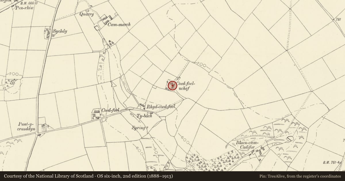
Slide toward Today to fade the historical sheet and see the modern map underneath.
David Rumsey Map Collection, Stanford LibrariesDavid Rumsey Map Collection, Stanford LibrariesDavid Rumsey Map Collection, Stanford LibrariesDavid Rumsey Map Collection, Stanford LibrariesDavid Rumsey Map Collection, Stanford Libraries
5 historical maps cover this location, the earliest the 1830 map "V.3:11-15:XV. Britisches Reich. A. Kon: England. b. Frstenthum Wales: Shire: 37-40" (David Rumsey Map Collection, Stanford Libraries).
Historical maps covering this location
- 1830 · V.3:11-15:XV. Britisches Reich. A. Kon: England. b. Frstenthum Wales: Shire: 37-40 (David Rumsey Map Collection, Stanford Libraries)
- 1860 · 41. Caermathen. (David Rumsey Map Collection, Stanford Libraries)
- 1899 · 194 Llangranog (Hills) (David Rumsey Map Collection, Stanford Libraries)
- 1901 · Sheet 14. (David Rumsey Map Collection, Stanford Libraries)
- 1919 · Sheet 78. Lampeter. (David Rumsey Map Collection, Stanford Libraries)
Cadw's description
Location
Enclosing E side of farm court.
Exterior
Long lofted outbuilding dated 'JJ 1872' in rubble stone with slate roof comprising barn to right, lofted cart-shed to centre and stable to left. To rear is mill-leat and wheel-pit. Outside steps on left end. Front has door to left with single stone lintel, centre broad camber-arched cart entry with stone voussoirs, small window each side with single stone lintels, and low loading door above under eaves. To right is barn entry with tall C20 ledged doors. Under eaves to right, a row of dove holes. Collar truss roof.
Reason for designation
Included as part of a well preserved later C19 farm group, all of the same date.
Nearby in the register
- Coedfoel UchafDomesticunder 1 mi
- Outbuilding on W side of farmcourt at Coedfoel UchafAgriculture and Subsistenceunder 1 mi
- Outbuilding to N of Farmhouse at CoedyfoelAgriculture and Subsistenceunder 1 mi
- Outbuilding to SE of Farmhouse at CoedfoelAgriculture and Subsistenceunder 1 mi
Other entries of the same register within about three miles of this one, by straight line.