Cof Cymru: National Historic Assets of Wales · Wales
Pantolwen Mills (S Building)
Llandysul, Ceredigion, Wales
A Grade II listed building in Pantolwen, Llandysul, Ceredigion, designated on 13 January 1993.
The record
- Designation
- Listed building, Grade II
- Broad class
- Industrial
- Date of designation
- 13 January 1993
- Locality
- Pantolwen
- Community
- Llandysul
- Unitary authority
- Ceredigion
- Country
- Wales
- Coordinates
- 52.05304, -4.31113
- Cadw reference
- 10616
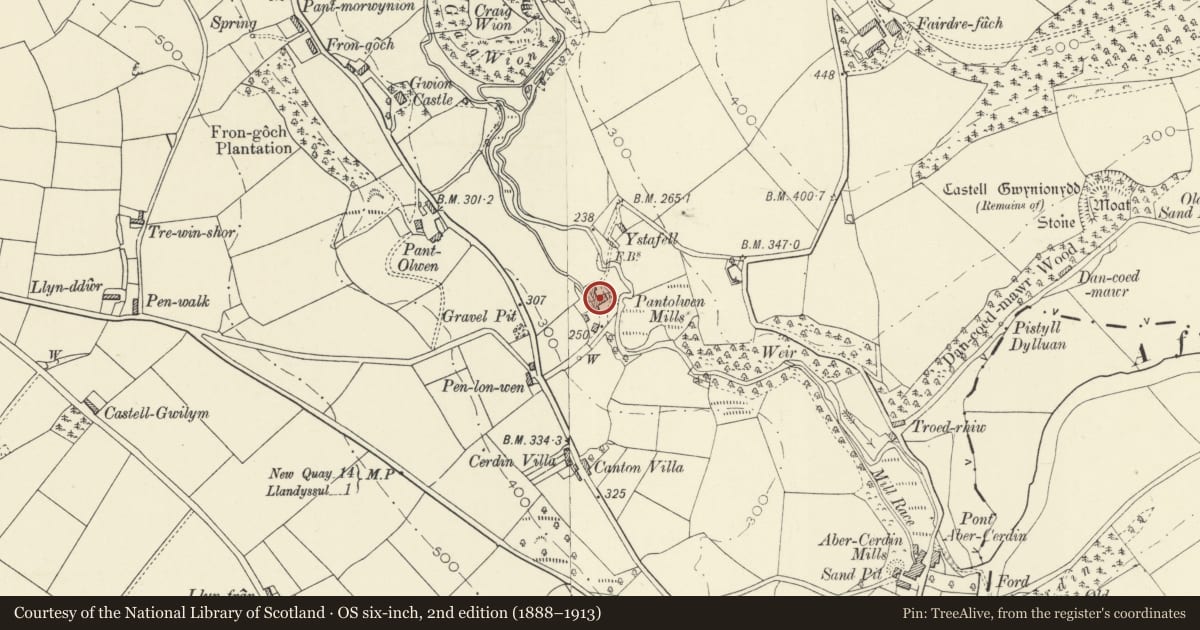
Slide toward Today to fade the historical sheet and see the modern map underneath.
David Rumsey Map Collection, Stanford LibrariesDavid Rumsey Map Collection, Stanford LibrariesDavid Rumsey Map Collection, Stanford LibrariesDavid Rumsey Map Collection, Stanford LibrariesDavid Rumsey Map Collection, Stanford Libraries
5 historical maps cover this location, the earliest the 1830 map "V.3:11-15:XV. Britisches Reich. A. Kon: England. b. Frstenthum Wales: Shire: 37-40" (David Rumsey Map Collection, Stanford Libraries).
Historical maps covering this location
- 1830 · V.3:11-15:XV. Britisches Reich. A. Kon: England. b. Frstenthum Wales: Shire: 37-40 (David Rumsey Map Collection, Stanford Libraries)
- 1860 · 41. Caermathen. (David Rumsey Map Collection, Stanford Libraries)
- 1899 · 194 Llangranog (Hills) (David Rumsey Map Collection, Stanford Libraries)
- 1901 · Sheet 14. (David Rumsey Map Collection, Stanford Libraries)
- 1919 · Sheet 78. Lampeter. (David Rumsey Map Collection, Stanford Libraries)
Cadw's description
Location
Situated on west bank of Afon Cerdin some 0.8 km SSE of Pentrellwyn.
History
Late C18
Exterior
Corn mill, later part of woollen mill complex, rubble stone with hipped slate roof; square plan, 3-storey but built into bank on W and N. S end has 2 small windows to each of upper floors and ground floor entry with big camber-headed doorway. East side door to first floor with timber lintel. Rear has 2 second-floor small windows. W side has single storey addition with chamfered angle. Mill-wheel was to the rear.
Mill seems to have been a corn mill incorporated into woollen mill complex built 1895.
Deteriorating condition (1991).
Interior
Heavy timbers to ground and first floor. Three bay collar-truss roof, the principals morticed to short posts inset in wall.
Nearby in the register
- Castell GwynionyddRingworkunder 1 mi
- Gorrig MillIndustrialunder 1 mi
- Gorrig FarmhouseDomesticunder 1 mi
- Ranges to rear of the Porth HotelCommercialunder 1 mi
Other entries of the same register within about three miles of this one, by straight line.