Cof Cymru: National Historic Assets of Wales · Wales
No 2 Richmond House
Llandysul, Ceredigion, Wales
A Grade II listed building in Llandysul, Ceredigion, designated on 13 January 1993.
The record
- Designation
- Listed building, Grade II
- Broad class
- Domestic
- Date of designation
- 13 January 1993
- Community
- Llandysul
- Unitary authority
- Ceredigion
- Country
- Wales
- Coordinates
- 52.04179, -4.30934
- Cadw reference
- 10577
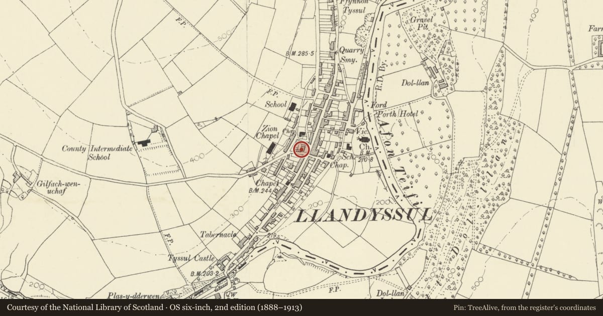
Slide toward Today to fade the historical sheet and see the modern map underneath.
David Rumsey Map Collection, Stanford LibrariesDavid Rumsey Map Collection, Stanford LibrariesDavid Rumsey Map Collection, Stanford LibrariesDavid Rumsey Map Collection, Stanford LibrariesDavid Rumsey Map Collection, Stanford Libraries
5 historical maps cover this location, the earliest the 1830 map "V.3:11-15:XV. Britisches Reich. A. Kon: England. b. Frstenthum Wales: Shire: 37-40" (David Rumsey Map Collection, Stanford Libraries).
Historical maps covering this location
- 1830 · V.3:11-15:XV. Britisches Reich. A. Kon: England. b. Frstenthum Wales: Shire: 37-40 (David Rumsey Map Collection, Stanford Libraries)
- 1860 · 41. Caermathen. (David Rumsey Map Collection, Stanford Libraries)
- 1891 · Sheet 10. Ordnance Survey of England and Wales. . (David Rumsey Map Collection, Stanford Libraries)
- 1898 · 211 Newcastle Emlyn (Hills) (David Rumsey Map Collection, Stanford Libraries)
- 1901 · Sheet 14. (David Rumsey Map Collection, Stanford Libraries)
Cadw's description
Location
Situated set back and on high terrace at main intersection of the town.
History
Circa 1870-80
Exterior
Large pair of stucco villas, 3-storey 5-window in 1-3-1 arrangement, with slate hipped roof and 3 stuccoed stacks. Centre is advanced with hipped roof. Each part has rusticated quoins, moulded string courses, moulded eaves cornice, 4-pane sashes with moulded labels and keystones and slate sills. Central window between 6-panel doors with overlights in tall stucco doorcases with console brackets to cornices. Deep overlights.
Two-window end elevations and big rear gable in rubble stone with stuccoed gable and end stack.
Set on high rubble stone terrace with c1900 intersected wire railing.
Reason for designation
A pair of Victorian villas of unusual scale and elaboration.
Nearby in the register
- No 1 Richmong HouseDomesticunder 1 mi
- 5 Barley MowCommercialunder 1 mi
- Carreg Llys, Wesley HillDomesticunder 1 mi
- Shop adjoining Carreg Llys, Wesley HillCommercialunder 1 mi
Other entries of the same register within about three miles of this one, by straight line.