Cof Cymru: National Historic Assets of Wales · Wales
Tabernacle Chapel
Llandysul, Ceredigion, Wales
A Grade II listed building in Llandysul, Ceredigion, designated on 13 January 1993.
The record
- Designation
- Listed building, Grade II
- Broad class
- Religious, Ritual and Funerary
- Date of designation
- 13 January 1993
- Community
- Llandysul
- Unitary authority
- Ceredigion
- Country
- Wales
- Coordinates
- 52.03938, -4.31184
- Cadw reference
- 10563
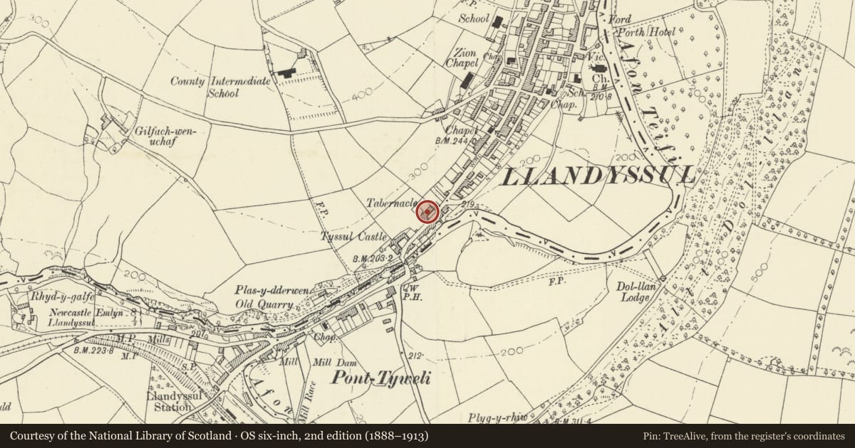
Slide toward Today to fade the historical sheet and see the modern map underneath.
David Rumsey Map Collection, Stanford LibrariesDavid Rumsey Map Collection, Stanford LibrariesDavid Rumsey Map Collection, Stanford LibrariesDavid Rumsey Map Collection, Stanford LibrariesDavid Rumsey Map Collection, Stanford Libraries
5 historical maps cover this location, the earliest the 1830 map "V.3:11-15:XV. Britisches Reich. A. Kon: England. b. Frstenthum Wales: Shire: 37-40" (David Rumsey Map Collection, Stanford Libraries).
Historical maps covering this location
- 1830 · V.3:11-15:XV. Britisches Reich. A. Kon: England. b. Frstenthum Wales: Shire: 37-40 (David Rumsey Map Collection, Stanford Libraries)
- 1860 · 41. Caermathen. (David Rumsey Map Collection, Stanford Libraries)
- 1891 · Sheet 10. Ordnance Survey of England and Wales. . (David Rumsey Map Collection, Stanford Libraries)
- 1898 · 211 Newcastle Emlyn (Hills) (David Rumsey Map Collection, Stanford Libraries)
- 1901 · Sheet 14. (David Rumsey Map Collection, Stanford Libraries)
Cadw's description
Location
Set back from street-line some 120m NE of Llandysul Bridge.
History
1832 altered later in C19.
Exterior
Calvinistic Methodist Chapel, stucco-fronted lateral facade of 2 long arched windows to centre, 2 arched outer doors with arched gallery windows above. All windows with original glazing bars and radiating bars to heads, matching fanlights over doors. Later C19 stucco facing with raised surrounds to windows, centre windows with linked sills and raised plaque between, doors in pilastered moulded doorcases, and raised strips at outer angles of facade.
A similar facade design to former Ebenezer Chapel in Lincoln Street of 1833.
Attached at E end, former chapel house, stucco with brick E end stack, door and one-window range.
Nearby in the register
- Former Chapel HouseReligious, Ritual and Funeraryunder 1 mi
- Dinarth HallDomesticunder 1 mi
- Rock HouseDomesticunder 1 mi
- RockleeDomesticunder 1 mi
Other entries of the same register within about three miles of this one, by straight line.