Cof Cymru: National Historic Assets of Wales · Wales
Delfryn including Garden Railings & Piers
Cardigan, Ceredigion, Wales
A Grade II listed building in Troedyrhiw, Cardigan, Ceredigion, designated on 14 April 1992.
The record
- Designation
- Listed building, Grade II
- Broad class
- Domestic
- Date of designation
- 14 April 1992
- Locality
- Troedyrhiw
- Community
- Cardigan
- Unitary authority
- Ceredigion
- Country
- Wales
- Coordinates
- 52.07018, -4.65899
- Cadw reference
- 10558
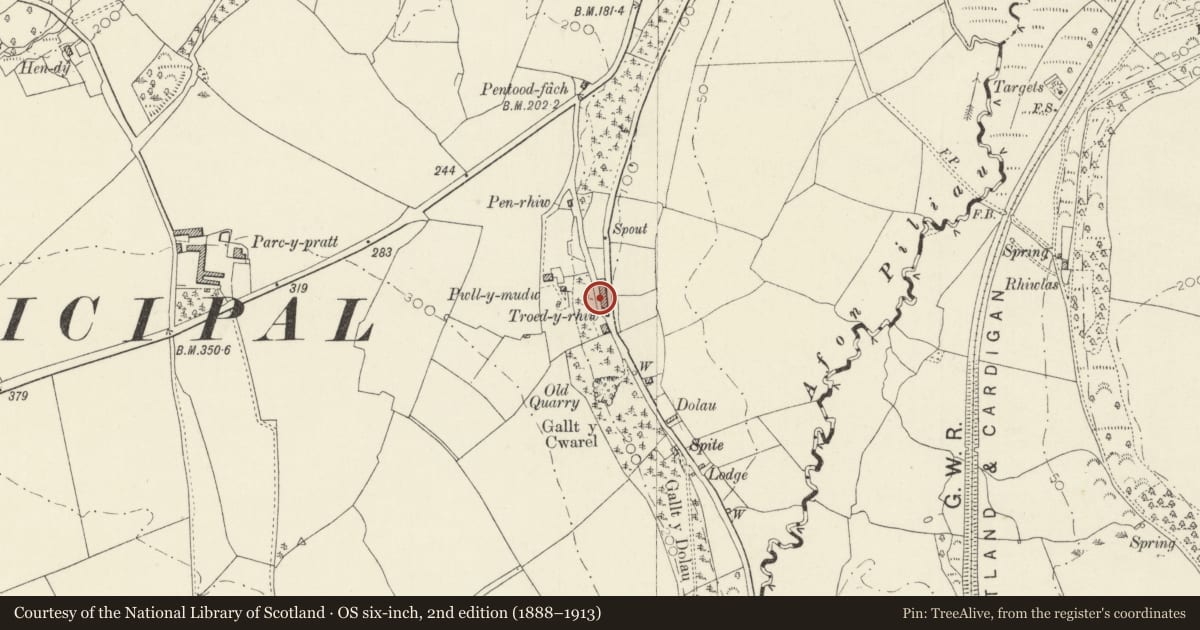
Slide toward Today to fade the historical sheet and see the modern map underneath.
David Rumsey Map Collection, Stanford LibrariesDavid Rumsey Map Collection, Stanford LibrariesDavid Rumsey Map Collection, Stanford LibrariesDavid Rumsey Map Collection, Stanford LibrariesDavid Rumsey Map Collection, Stanford Libraries
5 historical maps cover this location, the earliest the 1608 map "(13) Cambriae Typus." (David Rumsey Map Collection, Stanford Libraries).
Historical maps covering this location
- 1608 · (13) Cambriae Typus. (David Rumsey Map Collection, Stanford Libraries)
- 1636 · Cornubia : Devonia, Somersetus, Dorcestria, Wiltonia, Glocestria ... (David Rumsey Map Collection, Stanford Libraries)
- 1830 · V.3:11-15:XV. Britisches Reich. A. Kon: England. b. Frstenthum Wales: Shire: 37-40 (David Rumsey Map Collection, Stanford Libraries)
- 1898 · 193 Cardigan (Hills) (David Rumsey Map Collection, Stanford Libraries)
- 1901 · Sheet 13. (David Rumsey Map Collection, Stanford Libraries)
Cadw's description
Location
Situated in terraced row against hillside, some 1km south of Cardigan Bridge.
History
Early C19.
Exterior
House in whitewashed rubble stone with slate roof and whitewashed stone end stacks, larger to south end. Double-fronted 2-storey house with small 9-pane casements above, close to eaves, with slate sills and larger 4-pane sashes below, with recessed cambered stone voussoirs and slate sills. Similar head to centre 4-panel door. Lean-to against left wall.
Front garden enclosed by iron railings with whitewashed square piers.
Reason for designation
Included as good surviving example of smaller traditional house.
Nearby in the register
- Parc-y-PrattDomesticunder 1 mi
- Outbuilding to W of Parc-y-PrattDomesticunder 1 mi
- GlanpwllafanDomesticunder 1 mi
- Bridge WarehouseCommercialunder 1 mi
Other entries of the same register within about three miles of this one, by straight line.