Cof Cymru: National Historic Assets of Wales · Wales
The Angel Hotel
Cardigan, Ceredigion, Wales
A Grade II listed building in Cardigan, Ceredigion, designated on 16 June 1961.
The record
- Designation
- Listed building, Grade II
- Broad class
- Commercial
- Date of designation
- 16 June 1961
- Community
- Cardigan
- Unitary authority
- Ceredigion
- Country
- Wales
- Coordinates
- 52.08233, -4.65901
- Cadw reference
- 10537
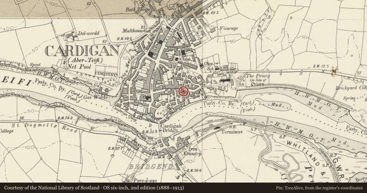
Slide toward Today to fade the historical sheet and see the modern map underneath.
David Rumsey Map Collection, Stanford LibrariesDavid Rumsey Map Collection, Stanford LibrariesDavid Rumsey Map Collection, Stanford LibrariesDavid Rumsey Map Collection, Stanford LibrariesDavid Rumsey Map Collection, Stanford Libraries
5 historical maps cover this location, the earliest the 1608 map "(13) Cambriae Typus." (David Rumsey Map Collection, Stanford Libraries).
Historical maps covering this location
- 1608 · (13) Cambriae Typus. (David Rumsey Map Collection, Stanford Libraries)
- 1637 · Particular description of Wales. Cambria seu Wallia (David Rumsey Map Collection, Stanford Libraries)
- 1830 · V.3:11-15:XV. Britisches Reich. A. Kon: England. b. Frstenthum Wales: Shire: 37-40 (David Rumsey Map Collection, Stanford Libraries)
- 1898 · 193 Cardigan (Hills) (David Rumsey Map Collection, Stanford Libraries)
- 1901 · Sheet 13. (David Rumsey Map Collection, Stanford Libraries)
Cadw's description
Location
Situated in continuous row, facing up Morgan Street.
History
Early C19 hotel. One of the principal inns of the town in the C19. Marked on Wood's 1834 map of Cardigan as the Angel Hotel.
Exterior
Stucco fronted rubble stone, with slate deep-eaved roof and rebuilt red brick end stacks. Three-storey 5-window range with bracketed eaves, 4-pane second floor sashes and plate glass first floor sashes, all with slate sills and stucco flat hoods, those to first floor also with keystones. Ground floor has carriage arch to left and door between 2 tripartite plate glass sashes, not aligned with windows above. Similar stucco hoods. Six-panel door, blank overlight and Roman Doric 2-column timber porch with pilaster responds, triglyph frieze and cornice.
Low 2-storey wing to right with C20 openings to each floor and slate roof.
Rear has brick window heads and long rubble stone rear wing.
Nearby in the register
- 32 St Marys StreetDomesticunder 1 mi
- Cardigan & Tivyside AdvertiserCommercialunder 1 mi
- 19 St Marys StreetDomesticunder 1 mi
- CemaesDomesticunder 1 mi
Other entries of the same register within about three miles of this one, by straight line.