Cof Cymru: National Historic Assets of Wales · Wales
8 St Marys Street
Cardigan, Ceredigion, Wales
A Grade II listed building in Cardigan, Ceredigion, designated on 14 April 1992.
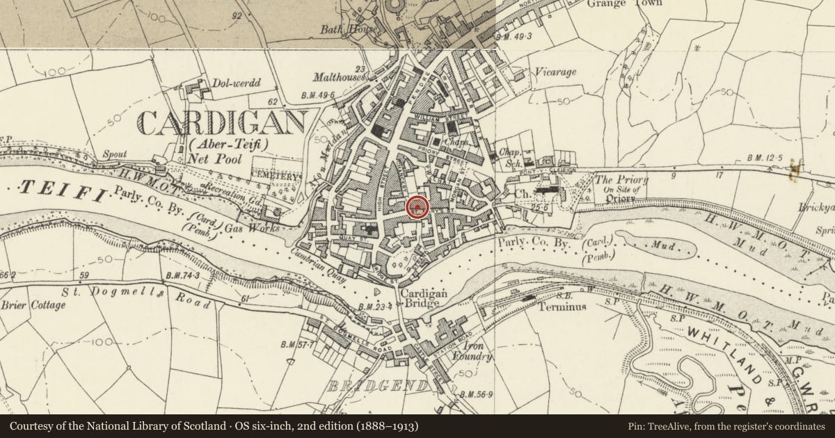
The record
- Designation
- Listed building, Grade II
- Broad class
- Domestic
- Date of designation
- 14 April 1992
- Community
- Cardigan
- Unitary authority
- Ceredigion
- Country
- Wales
- Coordinates
- 52.08247, -4.66010
- Cadw reference
- 10530
Slide toward Today to fade the historical sheet and see the modern map underneath.
David Rumsey Map Collection, Stanford LibrariesDavid Rumsey Map Collection, Stanford LibrariesDavid Rumsey Map Collection, Stanford LibrariesDavid Rumsey Map Collection, Stanford LibrariesDavid Rumsey Map Collection, Stanford Libraries
5 historical maps cover this location, the earliest the 1608 map "(13) Cambriae Typus." (David Rumsey Map Collection, Stanford Libraries).
Historical maps covering this location
- 1608 · (13) Cambriae Typus. (David Rumsey Map Collection, Stanford Libraries)
- 1637 · Particular description of Wales. Cambria seu Wallia (David Rumsey Map Collection, Stanford Libraries)
- 1830 · V.3:11-15:XV. Britisches Reich. A. Kon: England. b. Frstenthum Wales: Shire: 37-40 (David Rumsey Map Collection, Stanford Libraries)
- 1898 · 193 Cardigan (Hills) (David Rumsey Map Collection, Stanford Libraries)
- 1901 · Sheet 13. (David Rumsey Map Collection, Stanford Libraries)
Cadw's description
Location
Attached to No 7 and set back from street line.
History
C19
Exterior
House, probably service wing to No 7 to which it is attached. Rubble stone with inscribed pointing as on No 7, imitation slate roof, and brick stack at east end. Two storeys, double fronted, plate glass sashes to 2 upper windows and ground floor right, tripartite sash to ground floor left. Slate sills and cemented heads. Centre 6-panel door, all panels replaced in glass, hood on timber brackets.
Reason for designation
Included for group value.
Nearby in the register
- 9 St Marys StreetDomesticunder 1 mi
- 7 St Marys StreetDomesticunder 1 mi
- The Old StablesCommercialunder 1 mi
- Pedestrian Gate between no 43 & The Old StablesDomesticunder 1 mi
Other entries of the same register within about three miles of this one, by straight line.