Cof Cymru: National Historic Assets of Wales · Wales
The Castle Inn PH
Cardigan, Ceredigion, Wales
A Grade II listed building in Cardigan, Ceredigion, designated on 16 June 1961.
The record
- Designation
- Listed building, Grade II
- Broad class
- Commercial
- Date of designation
- 16 June 1961
- Community
- Cardigan
- Unitary authority
- Ceredigion
- Country
- Wales
- Coordinates
- 52.08027, -4.66041
- Cadw reference
- 10472
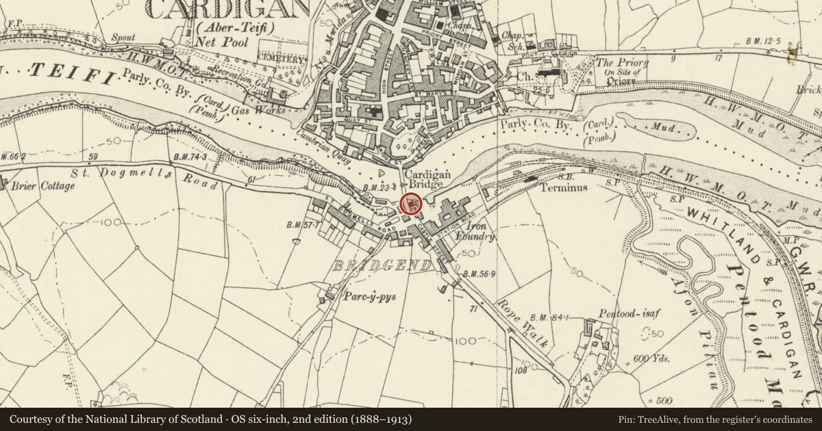
Slide toward Today to fade the historical sheet and see the modern map underneath.
David Rumsey Map Collection, Stanford LibrariesDavid Rumsey Map Collection, Stanford LibrariesDavid Rumsey Map Collection, Stanford LibrariesDavid Rumsey Map Collection, Stanford LibrariesDavid Rumsey Map Collection, Stanford Libraries
5 historical maps cover this location, the earliest the 1608 map "(13) Cambriae Typus." (David Rumsey Map Collection, Stanford Libraries).
Historical maps covering this location
- 1608 · (13) Cambriae Typus. (David Rumsey Map Collection, Stanford Libraries)
- 1637 · Particular description of Wales. Cambria seu Wallia (David Rumsey Map Collection, Stanford Libraries)
- 1830 · V.3:11-15:XV. Britisches Reich. A. Kon: England. b. Frstenthum Wales: Shire: 37-40 (David Rumsey Map Collection, Stanford Libraries)
- 1898 · 193 Cardigan (Hills) (David Rumsey Map Collection, Stanford Libraries)
- 1901 · Sheet 13. (David Rumsey Map Collection, Stanford Libraries)
Cadw's description
Location
Situated at south end of Cardigan Bridge.
History
Marked on 1834 map. Daniel Evans, architect of Bethania Chapel, owned the inn and died here 1852. He may have designed it.
Exterior
Inn, blue lias squared stone with slate roof and brick side wall stacks. Gable facade to street of two storeys and attic, 3-window range. Bargeboarded broad gable, attic tripartite lunette with slate sill and brick arch, 3 first floor windows under continuous timber lintel, plate glass sashes with slate sills, and ground floor centre door with window each side. Ground floor was similar to first floor with continuous timber lintel and sashes; 12-pane sash survives to right, but to left is canted timber bay window, not original but probably early to mid C19, with fascia and cornice surviving, glazing bars replaced with C20 stained hardwood. Centre door with 6 long panels, traceried overlight and doorcase with panelled timber pilasters, brackets and shelf hood.
North side wall to river is blank except for one ground floor window. South side has door with timber lintel and one altered window above.
Reason for designation
Group value with bridge.
Nearby in the register
- Bridge WarehouseCommercialunder 1 mi
- Cardigan BridgeBridgeunder 1 mi
- Cardigan BridgeTransportunder 1 mi
- Bridgend WarehouseCommercialunder 1 mi
Other entries of the same register within about three miles of this one, by straight line.