Cof Cymru: National Historic Assets of Wales · Wales
Outbuildings at Castle Green House Stable Yard
Cardigan, Ceredigion, Wales
A Grade II listed building in Cardigan, Ceredigion, designated on 14 April 1992.
The record
- Designation
- Listed building, Grade II
- Broad class
- Domestic
- Date of designation
- 14 April 1992
- Community
- Cardigan
- Unitary authority
- Ceredigion
- Country
- Wales
- Coordinates
- 52.08163, -4.66008
- Cadw reference
- 10461
Slide toward Today to fade the historical sheet and see the modern map underneath.
David Rumsey Map Collection, Stanford LibrariesDavid Rumsey Map Collection, Stanford LibrariesDavid Rumsey Map Collection, Stanford LibrariesDavid Rumsey Map Collection, Stanford LibrariesDavid Rumsey Map Collection, Stanford Libraries
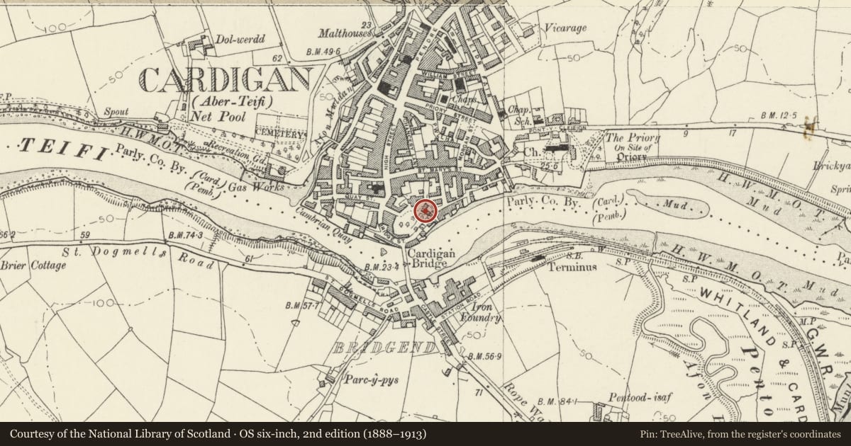
5 historical maps cover this location, the earliest the 1608 map "(13) Cambriae Typus." (David Rumsey Map Collection, Stanford Libraries).
Historical maps covering this location
- 1608 · (13) Cambriae Typus. (David Rumsey Map Collection, Stanford Libraries)
- 1637 · Particular description of Wales. Cambria seu Wallia (David Rumsey Map Collection, Stanford Libraries)
- 1830 · V.3:11-15:XV. Britisches Reich. A. Kon: England. b. Frstenthum Wales: Shire: 37-40 (David Rumsey Map Collection, Stanford Libraries)
- 1898 · 193 Cardigan (Hills) (David Rumsey Map Collection, Stanford Libraries)
- 1901 · Sheet 13. (David Rumsey Map Collection, Stanford Libraries)
Cadw's description
Location
Situated off The Strand by rear entrance drive to Castle Green House.
History
Circa 1828. Marked on Wood's 1834 map of Cardigan. In sale advert Carmarthen Journal 13.7.1832 a 4 stall stable and coach-house are mentioned, but no obvious coach house exists.
Exterior
Range of outbuildings in rubble stone with slate roofs. L-plan, 2-storey with cut blue lias stone voussoirs to openings. West range is gable ended to street with 3-window range, first floor window, window and loading door; ground floor door, window and door. Derelict interior with collar truss roof. Slightly recessed bay to right with superimposed cambered-head openings, linking to north range, also 3-window, but roof is lean-to against cliff-face behind. Smaller windows above with slate sills, centre window part blocked, ground floor 3 doors, left door part blocked, and small square window to right.
Stable yard enclosed on north east and east sides by rubble wall with 2 ashlar gate piers.
Main range has south end wall in banded stone with one window each floor.
Nearby in the register
- Retaining Wall in Castle Green Grounds to E of HouseDomesticunder 1 mi
- Cardigan CastleCastleunder 1 mi
- Castle Green HouseDomesticunder 1 mi
- Cardigan CastleDefenceunder 1 mi
Other entries of the same register within about three miles of this one, by straight line.