Cof Cymru: National Historic Assets of Wales · Wales
Glyncoed
Lampeter, Ceredigion, Wales
A Grade II listed building in Falcondale, Lampeter, Ceredigion, designated on 11 March 1992.
The record
- Designation
- Listed building, Grade II
- Broad class
- Domestic
- Date of designation
- 11 March 1992
- Locality
- Falcondale
- Community
- Lampeter
- Unitary authority
- Ceredigion
- Country
- Wales
- Coordinates
- 52.12203, -4.08935
- Cadw reference
- 10446
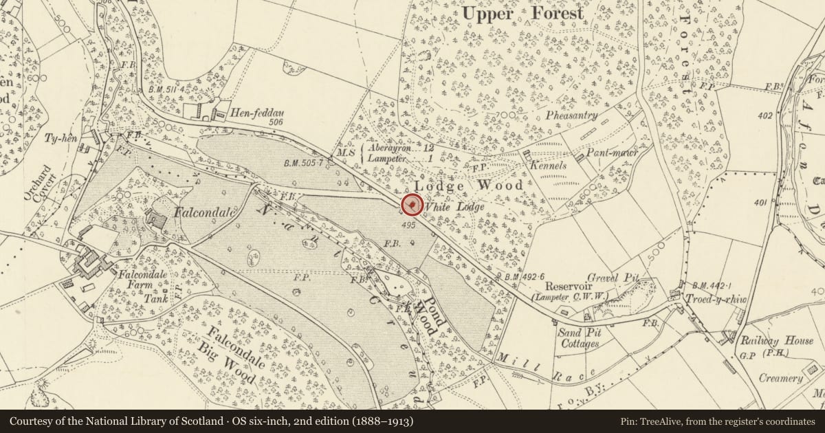
Slide toward Today to fade the historical sheet and see the modern map underneath.
David Rumsey Map Collection, Stanford LibrariesDavid Rumsey Map Collection, Stanford LibrariesDavid Rumsey Map Collection, Stanford LibrariesDavid Rumsey Map Collection, Stanford LibrariesDavid Rumsey Map Collection, Stanford Libraries
5 historical maps cover this location, the earliest the 1608 map "(13) Cambriae Typus." (David Rumsey Map Collection, Stanford Libraries).
Historical maps covering this location
- 1608 · (13) Cambriae Typus. (David Rumsey Map Collection, Stanford Libraries)
- 1830 · V.3:11-15:XV. Britisches Reich. A. Kon: England. b. Frstenthum Wales: Shire: 37-40 (David Rumsey Map Collection, Stanford Libraries)
- 1899 · 195 Lampeter (Hills) (David Rumsey Map Collection, Stanford Libraries)
- 1901 · Sheet 14. (David Rumsey Map Collection, Stanford Libraries)
- 1919 · Sheet 78. Lampeter. (David Rumsey Map Collection, Stanford Libraries)
Cadw's description
Location
Situated some 1.5 km N of Lampeter town centre, opposite entry to former drive to Falcondale.
History
c1860-70
Exterior
Lodge to Falcondale in squared blue lias stone with modern plain tiles to gabled roofs and 2 big S wall external chimneybreasts with truncated brick shafts. One and a half storeys, gable-ended to road. Gable has plain bargeboards, first floor small-paned metal casements with stone lintel and sill, brick jambs and segmental pointed relieving arch; ground floor canted bay window with iron lattice glazed casements and bracketed eaves to hipped tiled roof.
Set back wing to left has window and door, with brick jambs and heads under outshot roof held on 3 big timber brackets. N end gable has upper casement pair and modern ground floor window.
Nearby in the register
- MilestoneTransportunder 1 mi
- Falcondale HotelCommercialunder 1 mi
- Former Coach-house to Falcondale HouseDomesticunder 1 mi
- Falcondale Home FarmAgriculture and Subsistenceunder 1 mi
Other entries of the same register within about three miles of this one, by straight line.