Cof Cymru: National Historic Assets of Wales · Wales
Beech House (Doctor's Surgery)
Denbigh, Denbighshire, Wales
A Grade II listed building in Denbigh - Town, Denbigh, Denbighshire, designated on 2 February 1981.
The record
- Designation
- Listed building, Grade II
- Broad class
- Domestic
- Date of designation
- 2 February 1981
- Locality
- Denbigh - Town
- Community
- Denbigh
- Unitary authority
- Denbighshire
- Country
- Wales
- Coordinates
- 53.18555, -3.41516
- Cadw reference
- 1035
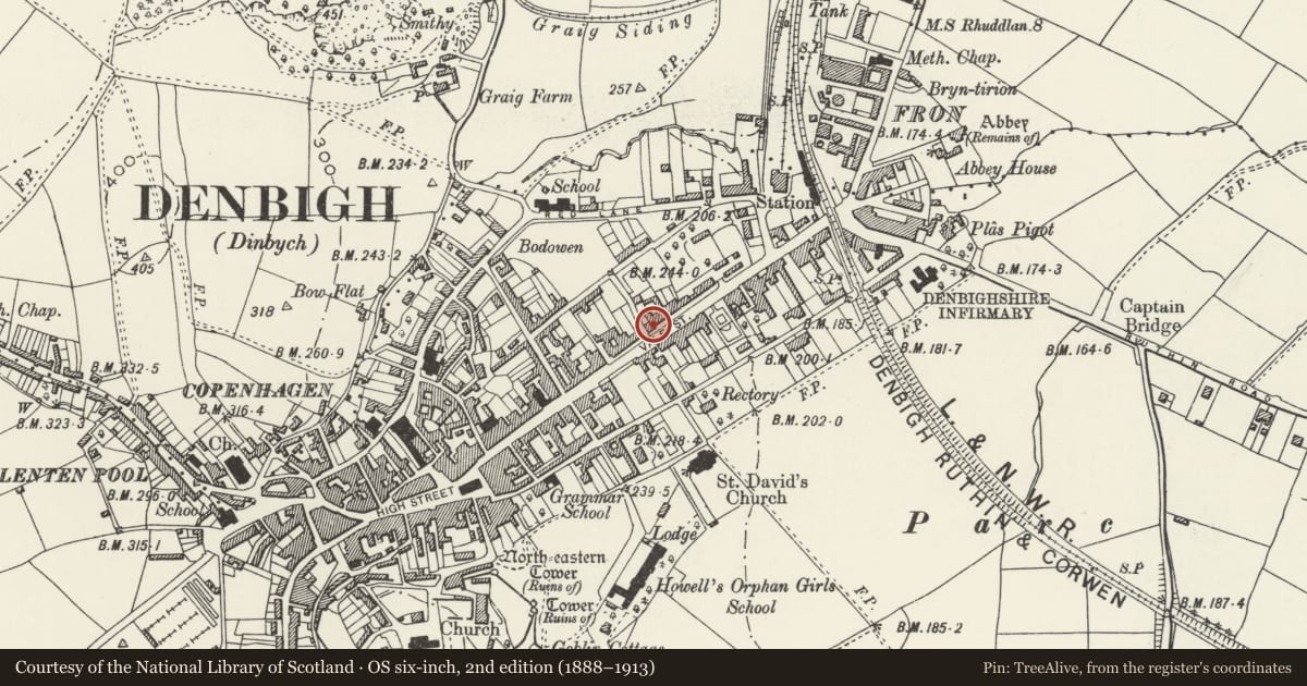
Slide toward Today to fade the historical sheet and see the modern map underneath.
David Rumsey Map Collection, Stanford LibrariesLlyfrgell Genedlaethol Cymru – The National Library of WalesDavid Rumsey Map Collection, Stanford LibrariesDavid Rumsey Map Collection, Stanford LibrariesDavid Rumsey Map Collection, Stanford Libraries
5 historical maps cover this location, the earliest the 1608 map "(13) Cambriae Typus." (David Rumsey Map Collection, Stanford Libraries).
Historical maps covering this location
- 1608 · (13) Cambriae Typus. (David Rumsey Map Collection, Stanford Libraries)
- 1795 · To Sir Watkin Williams-Wynn Bart ... the map of the six counties of North Wales is most… (Llyfrgell Genedlaethol Cymru – The National Library of Wales)
- 1830 · V.3:11-15:XV. Britisches Reich. A. Kon: England. b. Frstenthum Wales: Shire: 37-40 (David Rumsey Map Collection, Stanford Libraries)
- 1883 · Watershed map England, Wales 3. (David Rumsey Map Collection, Stanford Libraries)
- 1901 · Sheet 9 and 10. (David Rumsey Map Collection, Stanford Libraries)
Cadw's description
Location
Set back on the corner with Lon Copner behind a raised and rubble-revetted garden.
History
Early or second-quarter C19 detatched town house with later C19 alterations. In 1835 this was the town house of the Denbigh solicitor John Copner Willliams, and later the Wynne Edwards family of Plas Nantglyn, Nantglyn.
Exterior
Large detatched town house of 3 storeys; of brick and rubble construction with slate roof and plain rendered end chimneys. Symmetrical 3-bay pebble-dashed facade, with central, 8-pane French windows with marginal glazing and moulded cornice carried on fluted colonnettes. Flanking this are canted wooden bays with plain sashes and flat, parapetted roofs, also with moulded cornices. Similar marginally-glazed window to the first floor central bay with the remainder having plain 4-pane sash glazing; plain sill bands to the upper floors.
The return elevation to Lon Copner, on the left, has an entrance with 4-panel moulded doors having fielded upper panels surrounded by 5 lights. Porch with simple pediment of 4 paired metal posts; 12-pane sash window above.
Reason for designation
Listed for its special interest as a first-half C19 house retaining good external character in a prominent corner location.
Group value with other listed items in Vale Street; one of a number of fine town houses in this street, historically regarded as the gentry and professional quarter of the town.
Nearby in the register
- The HolliesDomesticunder 1 mi
- 70 Vale Street, incl forecourt walls and railingsDomesticunder 1 mi
- Canol Fryn, including forecourt walls and railingsDomesticunder 1 mi
- Bryn Collen, including forecourt walls and railingsDomesticunder 1 mi
Other entries of the same register within about three miles of this one, by straight line.