Cof Cymru: National Historic Assets of Wales · Wales
A T Mays Travel Agent
Aberystwyth, Ceredigion, Wales
A Grade II listed building in Aberystwyth, Ceredigion, designated on 24 November 1987.
The record
- Designation
- Listed building, Grade II
- Broad class
- Commercial
- Date of designation
- 24 November 1987
- Community
- Aberystwyth
- Unitary authority
- Ceredigion
- Country
- Wales
- Coordinates
- 52.41467, -4.08556
- Cadw reference
- 10306
Slide toward Today to fade the historical sheet and see the modern map underneath.
David Rumsey Map Collection, Stanford LibrariesDavid Rumsey Map Collection, Stanford LibrariesDavid Rumsey Map Collection, Stanford LibrariesDavid Rumsey Map Collection, Stanford LibrariesDavid Rumsey Map Collection, Stanford Libraries
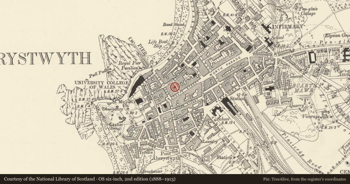
5 historical maps cover this location, the earliest the 1830 map "V.3:11-15:XV. Britisches Reich. A. Kon: England. b. Frstenthum Wales: Shire: 37-40" (David Rumsey Map Collection, Stanford Libraries).
Historical maps covering this location
- 1830 · V.3:11-15:XV. Britisches Reich. A. Kon: England. b. Frstenthum Wales: Shire: 37-40 (David Rumsey Map Collection, Stanford Libraries)
- 1883 · Watershed map England, Wales 3. (David Rumsey Map Collection, Stanford Libraries)
- 1896 · Sheet 7. Ordnance Survey of England and Wales. (David Rumsey Map Collection, Stanford Libraries)
- 1899 · 163 Aberystwyth (Hills) (David Rumsey Map Collection, Stanford Libraries)
- 1901 · Sheet 14. (David Rumsey Map Collection, Stanford Libraries)
Cadw's description
Location
Short terrace between Howells, on the corner of Great Darkgate Street, and the Talbot Hotel.
History
No 6 is also the Masonic Hall and No 8 was formerly a tavern. Completed by 1832 when the street was opened.
Exterior
Later Georgian, with Victoria alterations to No 6, 3-storey, 2-window scribed stucco and render fronts with moulded rusticated quoins to No 6. Slate roofs, bracket eaves and brick chimney stacks. Small-pane sash windows to Nos 4 and 8, with architraves to No 4. Ornate architraves with keystones and bracketed cills to No 6 with horned sash windows without glazing bars; central panel reads "Masonic Hall" with square and compass. Victorian shop fronts to Nos 4 and 6; plain pilasters to No 4 flank shop window with keeled colonnetes and splayed entrance with half glazed door, modern door to right; unusual bracketed end pieces to No 6 over faceted pilasters, modern fascia, 6-panel door and 4-right shop window with large Gothic colonnetes. Modern shop front to No 8.
Nearby in the register
- Dudes & DamesCommercialunder 1 mi
- Talbot HotelCommercialunder 1 mi
- G JonesCommercialunder 1 mi
- 7 Market StreetCommercialunder 1 mi
Other entries of the same register within about three miles of this one, by straight line.