Cof Cymru: National Historic Assets of Wales · Wales
19 Marine Terrace
Aberystwyth, Ceredigion, Wales
A Grade II listed building in Aberystwyth, Ceredigion, designated on 18 February 1987.
The record
- Designation
- Listed building, Grade II
- Broad class
- Domestic
- Date of designation
- 18 February 1987
- Community
- Aberystwyth
- Unitary authority
- Ceredigion
- Country
- Wales
- Coordinates
- 52.41625, -4.08507
- Cadw reference
- 10279
Slide toward Today to fade the historical sheet and see the modern map underneath.
David Rumsey Map Collection, Stanford LibrariesDavid Rumsey Map Collection, Stanford LibrariesDavid Rumsey Map Collection, Stanford LibrariesDavid Rumsey Map Collection, Stanford LibrariesInternet Archive
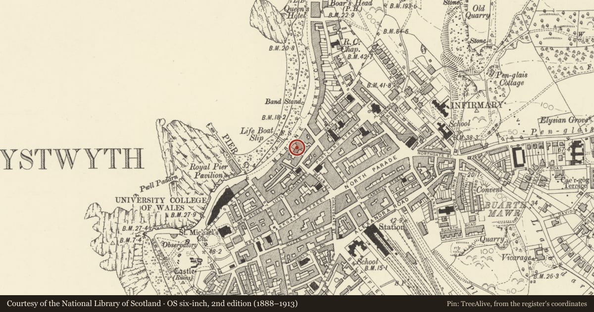
5 historical maps cover this location, the earliest the 1883 map "Watershed map England, Wales 3." (David Rumsey Map Collection, Stanford Libraries).
Historical maps covering this location
- 1883 · Watershed map England, Wales 3. (David Rumsey Map Collection, Stanford Libraries)
- 1896 · Sheet 7. Ordnance Survey of England and Wales. (David Rumsey Map Collection, Stanford Libraries)
- 1899 · 163 Aberystwyth (Hills) (David Rumsey Map Collection, Stanford Libraries)
- 1901 · Sheet 14. (David Rumsey Map Collection, Stanford Libraries)
- 1941 · Aberystwyth. (Internet Archive)
Cadw's description
Location
Short terrace set back from the adjoining Promenade frontages, the Belle Vue Royal Hotel to left; railed gardens to the front.
History
Shown on 1834 map; Victorian alterations, primarily the addition of full height splayed bay windows said to be the result of the Council’s lease renewal conditions ca. 1900.
Exterior
3-storey, basement and attic stucco fronts of varying widths; 2-window, to Nos 19 and 20, broader to No 19 and 3-window, double fronted, to No 18. End pilaster strips, 1st floor cill band and rusticated ground floor, channelled to No 18. Slate roofs, modern to No 20; bracket eaves and cement render chimney stacks. Horned sash glazing; pitched roof dormers with bargeboards, bay windows flank central entrance of No 18 and to left of entrances of Nos 19 and 20. Cornices to bays and architraves to other windows. Victorian half glazed raised porches with ornate ironwork parapets, No 18 with coloured glass. Half-glazed door to No 18, Nos 29 and 20 have 6-panel doors, with panelled reveals and traceried fanlight to No 20. All reached by steps with original interlace railings mixed glazing to basement.
Reason for designation
Included for group value.
Nearby in the register
- 20 Marine TerraceDomesticunder 1 mi
- 18 Marine TerraceDomesticunder 1 mi
- 17 Marine TerraceDomesticunder 1 mi
- Belle Vue Royal HotelCommercialunder 1 mi
Other entries of the same register within about three miles of this one, by straight line.