Cof Cymru: National Historic Assets of Wales · Wales
Staff House
Aberystwyth, Ceredigion, Wales
A Grade II* listed building in Aberystwyth, Ceredigion, designated on 21 July 1961.
The record
- Designation
- Listed building, Grade II*
- Broad class
- Domestic
- Date of designation
- 21 July 1961
- Community
- Aberystwyth
- Unitary authority
- Ceredigion
- Country
- Wales
- Coordinates
- 52.41404, -4.08741
- Cadw reference
- 10265
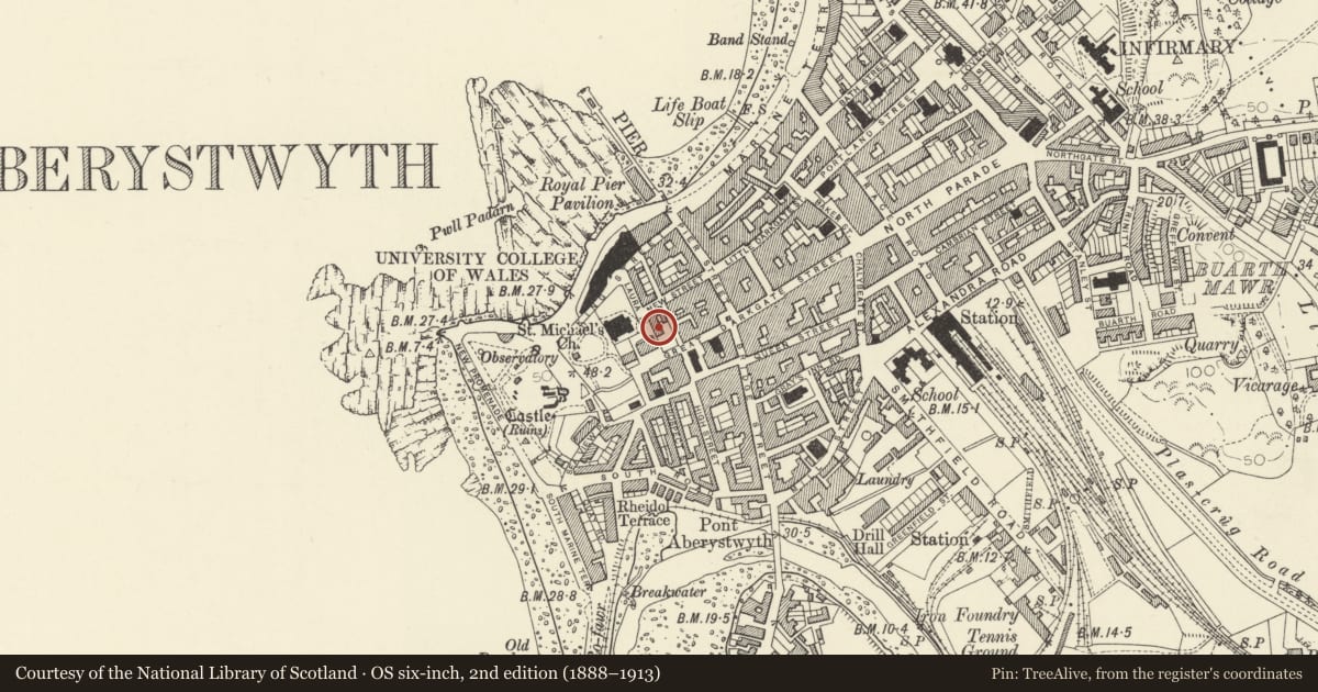
Slide toward Today to fade the historical sheet and see the modern map underneath.
David Rumsey Map Collection, Stanford LibrariesDavid Rumsey Map Collection, Stanford LibrariesDavid Rumsey Map Collection, Stanford LibrariesDavid Rumsey Map Collection, Stanford LibrariesDavid Rumsey Map Collection, Stanford Libraries
5 historical maps cover this location, the earliest the 1830 map "V.3:11-15:XV. Britisches Reich. A. Kon: England. b. Frstenthum Wales: Shire: 37-40" (David Rumsey Map Collection, Stanford Libraries).
Historical maps covering this location
- 1830 · V.3:11-15:XV. Britisches Reich. A. Kon: England. b. Frstenthum Wales: Shire: 37-40 (David Rumsey Map Collection, Stanford Libraries)
- 1883 · Watershed map England, Wales 3. (David Rumsey Map Collection, Stanford Libraries)
- 1896 · Sheet 7. Ordnance Survey of England and Wales. (David Rumsey Map Collection, Stanford Libraries)
- 1899 · 163 Aberystwyth (Hills) (David Rumsey Map Collection, Stanford Libraries)
- 1901 · Sheet 14. (David Rumsey Map Collection, Stanford Libraries)
Cadw's description
History
So named after W E Powell of Nanteos married Laura Phelps.Built in 1810’s, possibly by George Repton; No 9 extended to right ca 1900.
Exterior
To S of New Street, stepped in the slope overlooking St Michael’s and All Angels Parish Church to W.
2-storey basement and attic fronts; Nos 7 and 8 are 3-window and cement render, No 9 stepped up is 3+1 window and rendered; all scribed to 1st floor and channelled to ground floor with quoins. Slate roofs, bracket eaves and cement render, rubble and brick chimney stacks. Victorian dormers to Nos 7 and 8 with cusped bargeboards, modern dormers to No 9 with grouped floors; No 9 has raised pediments to 1st floor over a stringcourse at the eaves level of Nos 7 and 8. Scribed cement render left end with raised entrance no No 7, fine fluted column doorcase with wide cornice, panelled reveals and door with traceried fanlight. Similar doorcases to Nos 8 and 9, double doors to No 8. Stringcourse of No 9 continues around right side with pediments over bolection moulded lintels; shutters to sash windows without glazing bars. SE corner has Edwardian octagonal ‘prospect tower’ with small panes to upper sashes, egg and dart cornice and volute brackets. Part rubble rear with tall 18-pane sash to staircase, rubble rear to Nos 7 and 8.
All retain contemporary wrought iron railings with interlace balusters. No 9 bounded to right by cement rendered wall.
Interior
Interiors retain substantial contemporary detail particularly to entrance halls. No 8 has stairwell arch carried on paired fluted Doric columns with acanthus ornament and panelled soffit. Reeded doorcases etc.
Reason for designation
Group value with other listed items in Laura Place, Great Darkgate Street, King Street and New Street.
Nearby in the register
- 8 Laura PlaceDomesticunder 1 mi
- The RectoryDomesticunder 1 mi
- Former Assembly Rooms of Music & DramaEducationunder 1 mi
- 20 New StreetDomesticunder 1 mi
Other entries of the same register within about three miles of this one, by straight line.