Cof Cymru: National Historic Assets of Wales · Wales
Former Vestry to Paris Church of St Michael & All Angels
Aberystwyth, Ceredigion, Wales
A Grade II listed building in Aberystwyth, Ceredigion, designated on 24 November 1987.
The record
- Designation
- Listed building, Grade II
- Broad class
- Religious, Ritual and Funerary
- Date of designation
- 24 November 1987
- Community
- Aberystwyth
- Unitary authority
- Ceredigion
- Country
- Wales
- Coordinates
- 52.41374, -4.08904
- Cadw reference
- 10256
Slide toward Today to fade the historical sheet and see the modern map underneath.
David Rumsey Map Collection, Stanford LibrariesDavid Rumsey Map Collection, Stanford LibrariesDavid Rumsey Map Collection, Stanford LibrariesDavid Rumsey Map Collection, Stanford LibrariesDavid Rumsey Map Collection, Stanford Libraries
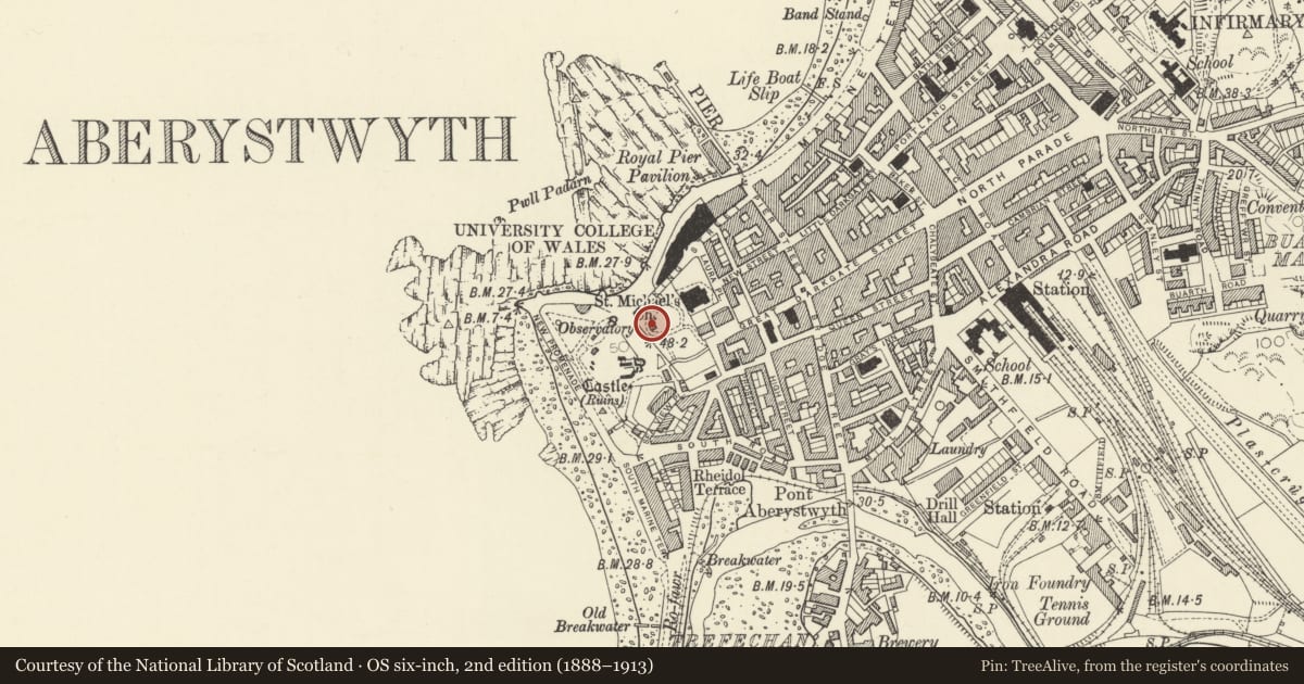
5 historical maps cover this location, the earliest the 1830 map "V.3:11-15:XV. Britisches Reich. A. Kon: England. b. Frstenthum Wales: Shire: 37-40" (David Rumsey Map Collection, Stanford Libraries).
Historical maps covering this location
- 1830 · V.3:11-15:XV. Britisches Reich. A. Kon: England. b. Frstenthum Wales: Shire: 37-40 (David Rumsey Map Collection, Stanford Libraries)
- 1883 · Watershed map England, Wales 3. (David Rumsey Map Collection, Stanford Libraries)
- 1896 · Sheet 7. Ordnance Survey of England and Wales. (David Rumsey Map Collection, Stanford Libraries)
- 1899 · 163 Aberystwyth (Hills) (David Rumsey Map Collection, Stanford Libraries)
- 1901 · Sheet 14. (David Rumsey Map Collection, Stanford Libraries)
Cadw's description
Location
Situated to the W of the Parish Church.
History
The former vestry to the Gothic second St Michael's Church which was completed in 1833 by Edward Haycock of Shrewsbury; intended to be the base of a tower that was never built.
Exterior
Ruined single storey rubble, part coursed, structure; formerly slate roofed with gable parapet to W. 2 pointed arches to E with voussoirs, lower to left leading to vice; Decorated 2-light window to W. C19 slate monuments inside.
Reason for designation
Included for group value.
Nearby in the register
- Parish Church of St Michael and All AngelsReligious, Ritual and Funeraryunder 1 mi
- 12 Laura PlaceDomesticunder 1 mi
- Aberystwyth CastleDefenceunder 1 mi
- 11 Laura PlaceDomesticunder 1 mi
Other entries of the same register within about three miles of this one, by straight line.