Cof Cymru: National Historic Assets of Wales · Wales
The Old Mill
Aberaeron, Ceredigion, Wales
A Grade II listed building in Aberaeron, Ceredigion, designated on 25 September 1986.
The record
- Designation
- Listed building, Grade II
- Broad class
- Industrial
- Date of designation
- 25 September 1986
- Locality
- Aberaeron
- Community
- Aberaeron
- Unitary authority
- Ceredigion
- Country
- Wales
- Coordinates
- 52.24116, -4.25904
- Cadw reference
- 10165
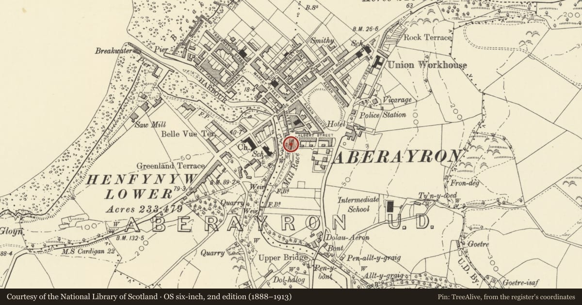
Slide toward Today to fade the historical sheet and see the modern map underneath.
David Rumsey Map Collection, Stanford LibrariesDavid Rumsey Map Collection, Stanford LibrariesDavid Rumsey Map Collection, Stanford LibrariesDavid Rumsey Map Collection, Stanford LibrariesDavid Rumsey Map Collection, Stanford Libraries
5 historical maps cover this location, the earliest the 1830 map "V.3:11-15:XV. Britisches Reich. A. Kon: England. b. Frstenthum Wales: Shire: 37-40" (David Rumsey Map Collection, Stanford Libraries).
Historical maps covering this location
- 1830 · V.3:11-15:XV. Britisches Reich. A. Kon: England. b. Frstenthum Wales: Shire: 37-40 (David Rumsey Map Collection, Stanford Libraries)
- 1898 · 177 Aberaeron (Hills) (David Rumsey Map Collection, Stanford Libraries)
- 1898 · 177 Aberaeron (Outline) (David Rumsey Map Collection, Stanford Libraries)
- 1901 · Sheet 14. (David Rumsey Map Collection, Stanford Libraries)
- 1919 · Sheet 78. Lampeter. (David Rumsey Map Collection, Stanford Libraries)
Cadw's description
Location
Situated at the corner with Albert Street and reached by a path beside the former Forge, part of a row of former industrial buildings contained a forge, woollen mill, woodturners workshop and tannery. Front (W side) overlooks the River Aeron.
History
c1850
Exterior
3-storey, 4-window whitewashed rubble front; slate roof, narrow eaves. Pivot windows with cambered heads to ground and first floors, arched entrance to ground floor, later conservatory extension against garden wall with hood on decorative cast iron brackets over timber door with Art Nouveau glass.
Rubble left end wall, cement render right end wall, various openings to rear with brick quoins.
2-storey whitewashed rubble building adjoining to right not of special interest.
Reason for designation
Group value.
Nearby in the register
- The ForgeIndustrialunder 1 mi
- 14 Water StreetDomesticunder 1 mi
- 20 Albert StreetDomesticunder 1 mi
- 13 Water StreetDomesticunder 1 mi
Other entries of the same register within about three miles of this one, by straight line.