Cof Cymru: National Historic Assets of Wales · Wales
4 Victoria Street
Aberaeron, Ceredigion, Wales
A Grade II listed building in Aberaeron, Ceredigion, designated on 25 September 1986.
The record
- Designation
- Listed building, Grade II
- Broad class
- Domestic
- Date of designation
- 25 September 1986
- Locality
- Aberaeron
- Community
- Aberaeron
- Unitary authority
- Ceredigion
- Country
- Wales
- Coordinates
- 52.24342, -4.25944
- Cadw reference
- 10137
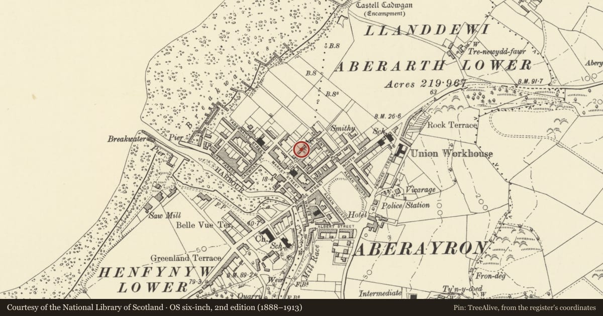
Slide toward Today to fade the historical sheet and see the modern map underneath.
David Rumsey Map Collection, Stanford LibrariesDavid Rumsey Map Collection, Stanford LibrariesDavid Rumsey Map Collection, Stanford LibrariesDavid Rumsey Map Collection, Stanford LibrariesDavid Rumsey Map Collection, Stanford Libraries
5 historical maps cover this location, the earliest the 1830 map "V.3:11-15:XV. Britisches Reich. A. Kon: England. b. Frstenthum Wales: Shire: 37-40" (David Rumsey Map Collection, Stanford Libraries).
Historical maps covering this location
- 1830 · V.3:11-15:XV. Britisches Reich. A. Kon: England. b. Frstenthum Wales: Shire: 37-40 (David Rumsey Map Collection, Stanford Libraries)
- 1898 · 177 Aberaeron (Hills) (David Rumsey Map Collection, Stanford Libraries)
- 1898 · 177 Aberaeron (Outline) (David Rumsey Map Collection, Stanford Libraries)
- 1901 · Sheet 14. (David Rumsey Map Collection, Stanford Libraries)
- 1919 · Sheet 78. Lampeter. (David Rumsey Map Collection, Stanford Libraries)
Cadw's description
Location
SW end of a broken terrace forward to the street between the corner with Castle Lane and the set back Roman Catholic Church.
History
Part of the mid C19 (after ca 1845) town plan.
Exterior
Simple classical 2-storey 3-window scribed render frontages with rusticated quoins. Slate roofs, hipped and advanced to end pavilion (No1) with cresting; wide boarded eaves, 7 cement render stacks. No 3 has rusticated ground floor. 12-pane sash windows to Nos 2, 3 and 5, later 2-pane sash windows to Nos 1, 4 and 6, lugged architraves and keystones to all except No 3 which has lintels. Similar detail to entrances, panelled doors to Nos 2 to 6 (modern to No 5), and modern door to No 1.
Reason for designation
Included for group value.
Nearby in the register
- 3 Victoria StreetDomesticunder 1 mi
- 5 Victoria StreetDomesticunder 1 mi
- 2 Victoria StreetDomesticunder 1 mi
- 6 Victoris StreetDomesticunder 1 mi
Other entries of the same register within about three miles of this one, by straight line.