Cof Cymru: National Historic Assets of Wales · Wales
3 Quay Parade
Aberaeron, Ceredigion, Wales
A Grade II listed building in Aberaeron, Ceredigion, designated on 28 September 1961.
The record
- Designation
- Listed building, Grade II
- Broad class
- Domestic
- Date of designation
- 28 September 1961
- Locality
- Aberaeron
- Community
- Aberaeron
- Unitary authority
- Ceredigion
- Country
- Wales
- Coordinates
- 52.24335, -4.26293
- Cadw reference
- 10094
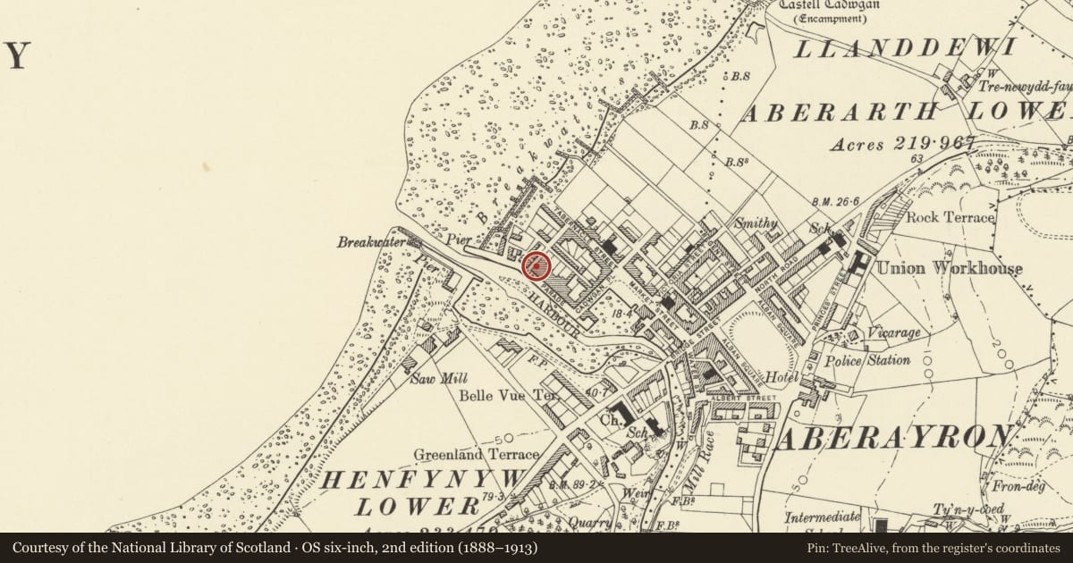
Slide toward Today to fade the historical sheet and see the modern map underneath.
David Rumsey Map Collection, Stanford LibrariesDavid Rumsey Map Collection, Stanford LibrariesDavid Rumsey Map Collection, Stanford LibrariesDavid Rumsey Map Collection, Stanford LibrariesDavid Rumsey Map Collection, Stanford Libraries
5 historical maps cover this location, the earliest the 1830 map "V.3:11-15:XV. Britisches Reich. A. Kon: England. b. Frstenthum Wales: Shire: 37-40" (David Rumsey Map Collection, Stanford Libraries).
Historical maps covering this location
- 1830 · V.3:11-15:XV. Britisches Reich. A. Kon: England. b. Frstenthum Wales: Shire: 37-40 (David Rumsey Map Collection, Stanford Libraries)
- 1898 · 177 Aberaeron (Hills) (David Rumsey Map Collection, Stanford Libraries)
- 1898 · 177 Aberaeron (Outline) (David Rumsey Map Collection, Stanford Libraries)
- 1901 · Sheet 14. (David Rumsey Map Collection, Stanford Libraries)
- 1919 · Sheet 78. Lampeter. (David Rumsey Map Collection, Stanford Libraries)
Cadw's description
Location
Facing SW overlooking the harbour, at the end of the parade close to the Harbourmaster Hotel and on the corner with Waterloo Street.
History
Early C19 (probably in existence by 1819).
Exterior
Pair of semi-detached simple classical
2-storey 3-window roughcast fronts with later C19 decorative alterations. End pilaster strips, cill bands and plinth; slate roofs; 3 cement render chimney stacks. 12 pane sash windows to No 3, 2-light sash windows to No 4, ground floor to No 3 also has one later rectangular window with 2 narrow casements flanking fixed glazed centre all with lugged architraves and No 4 has keystones. Asymmetrical architrave to porch to No 3 and recessed 6-panel door with fanlight; low flood wall in front with ramped walkway to right and higher protection wall under doorway. No 4 has later pitched roof projecting porch with 2 light sash windows and half-glazed door within, Roughcast end walls.
Reason for designation
Group value.
Nearby in the register
- Gwel-y-WeryddDomesticunder 1 mi
- Harbourmaster Hotel (Formerly the Red Lion Hotel)Commercialunder 1 mi
- 5 Quay ParadeDomesticunder 1 mi
- ArbaDomesticunder 1 mi
Other entries of the same register within about three miles of this one, by straight line.