Cof Cymru: National Historic Assets of Wales · Wales
Midland Bank including No9 Alban Square
Aberaeron, Ceredigion, Wales
A Grade II* listed building in Aberaeron, Ceredigion, designated on 28 September 1961.
The record
- Designation
- Listed building, Grade II*
- Broad class
- Commercial
- Date of designation
- 28 September 1961
- Locality
- Aberaeron
- Community
- Aberaeron
- Unitary authority
- Ceredigion
- Country
- Wales
- Coordinates
- 52.24296, -4.25749
- Cadw reference
- 10077
Slide toward Today to fade the historical sheet and see the modern map underneath.
David Rumsey Map Collection, Stanford LibrariesDavid Rumsey Map Collection, Stanford LibrariesDavid Rumsey Map Collection, Stanford LibrariesDavid Rumsey Map Collection, Stanford LibrariesDavid Rumsey Map Collection, Stanford Libraries
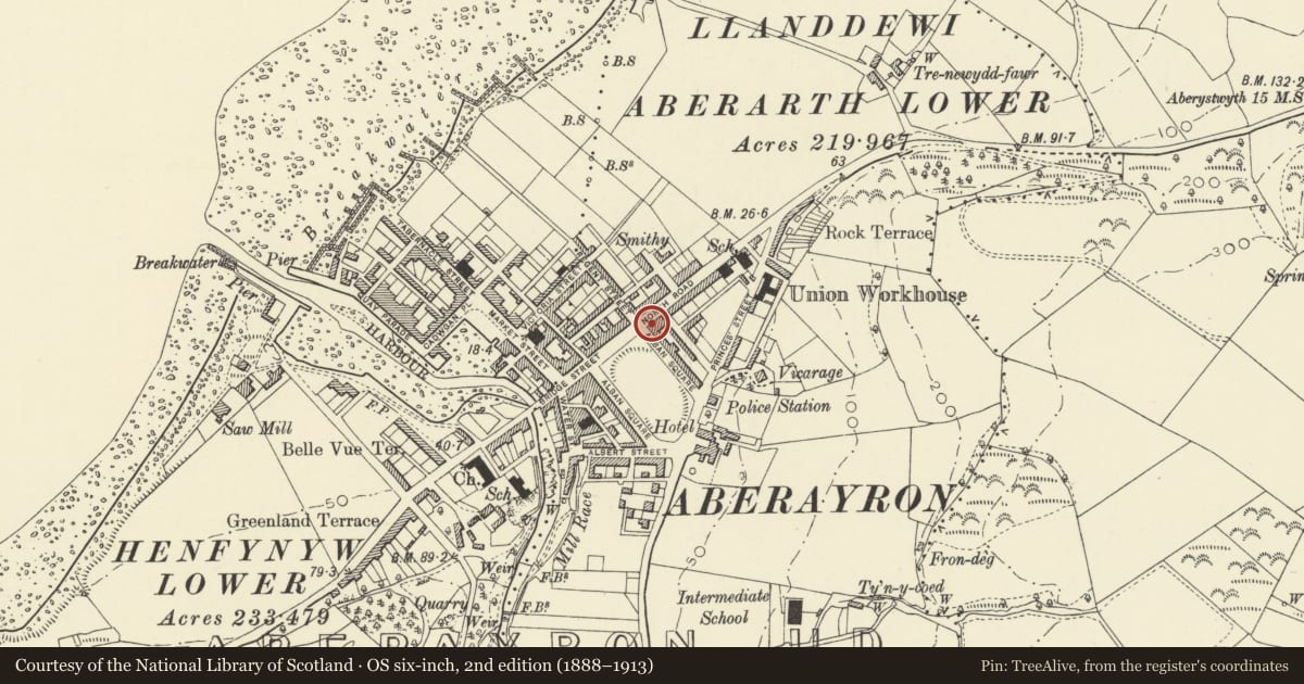
5 historical maps cover this location, the earliest the 1830 map "V.3:11-15:XV. Britisches Reich. A. Kon: England. b. Frstenthum Wales: Shire: 37-40" (David Rumsey Map Collection, Stanford Libraries).
Historical maps covering this location
- 1830 · V.3:11-15:XV. Britisches Reich. A. Kon: England. b. Frstenthum Wales: Shire: 37-40 (David Rumsey Map Collection, Stanford Libraries)
- 1898 · 177 Aberaeron (Hills) (David Rumsey Map Collection, Stanford Libraries)
- 1898 · 177 Aberaeron (Outline) (David Rumsey Map Collection, Stanford Libraries)
- 1901 · Sheet 14. (David Rumsey Map Collection, Stanford Libraries)
- 1919 · Sheet 78. Lampeter. (David Rumsey Map Collection, Stanford Libraries)
Cadw's description
Location
Advanced at the corner of Alban Square (NE side).
History
Mid C19 (after ca 1845).
Exterior
Simple classical 2-storey 3-window scribed render front with end pilaster strips and plinth forming an advanced hipped roof end pavilion to this side of North Road and the NE side of Alban Square. Slate roof and wide boarded eaves. 12-pane sashes to first floor, 16-pane to ground floor; all with lugged architraves and ornamental keystones. Tall narrow open-pedimented doorcase with timber columns on high bases, arched entrance with 7-panel door.
Similar Alban Square elevation except that the former entrance is blocked by a semicircular headed sash window with glazing bars curved at the top.
Reason for designation
Grade II* as the end pavilion to a Grade II* well preserved terrace in a key location (Alban Square NE side). Group value.
Nearby in the register
- 10 Alban SquareDomesticunder 1 mi
- Midland Bank ChambersCommercialunder 1 mi
- 11 Alban SquareDomesticunder 1 mi
- Royal Oak P.H.Commercialunder 1 mi
Other entries of the same register within about three miles of this one, by straight line.