Cof Cymru: National Historic Assets of Wales · Wales
Penlan
Aberaeron, Ceredigion, Wales
A Grade II listed building in Aberaeron, Ceredigion, designated on 28 September 1961.
The record
- Designation
- Listed building, Grade II
- Broad class
- Domestic
- Date of designation
- 28 September 1961
- Locality
- Aberaeron
- Community
- Aberaeron
- Unitary authority
- Ceredigion
- Country
- Wales
- Coordinates
- 52.24050, -4.26247
- Cadw reference
- 10014
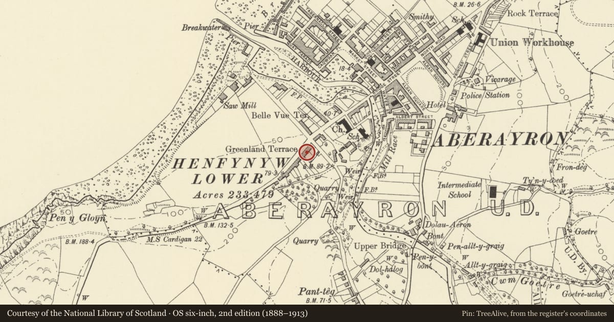
Slide toward Today to fade the historical sheet and see the modern map underneath.
David Rumsey Map Collection, Stanford LibrariesDavid Rumsey Map Collection, Stanford LibrariesDavid Rumsey Map Collection, Stanford LibrariesDavid Rumsey Map Collection, Stanford LibrariesDavid Rumsey Map Collection, Stanford Libraries
5 historical maps cover this location, the earliest the 1830 map "V.3:11-15:XV. Britisches Reich. A. Kon: England. b. Frstenthum Wales: Shire: 37-40" (David Rumsey Map Collection, Stanford Libraries).
Historical maps covering this location
- 1830 · V.3:11-15:XV. Britisches Reich. A. Kon: England. b. Frstenthum Wales: Shire: 37-40 (David Rumsey Map Collection, Stanford Libraries)
- 1898 · 177 Aberaeron (Hills) (David Rumsey Map Collection, Stanford Libraries)
- 1898 · 177 Aberaeron (Outline) (David Rumsey Map Collection, Stanford Libraries)
- 1901 · Sheet 14. (David Rumsey Map Collection, Stanford Libraries)
- 1919 · Sheet 78. Lampeter. (David Rumsey Map Collection, Stanford Libraries)
Cadw's description
Location
Set on rising ground on the SW edge of the town linked to Nos 2 and 3 to left by screen wall above side passage; stepped in the slope and set back with gardens to the front.
History
Mid C19 (after ca 1845).
Exterior
Pair of simple classical 2-storey (and basement to No 4), 3-window roughcast frontages with uniform hipped slate roof; wide boarded eaves, 2 rubble end chimney stacks and 1 to centre. 16-pane sash windows with lintels. Pedimented late Georgian doorcase to No 4 with panelled reveals to semi-circular arched entrance, vertically panelled door with 5-pane fanlight. Semi-Circular headed doorcase to No 5 with unusual detail; rope-moulded hood on barley twist columns with plain bases. Panelled reveals, 6-panel door and 6-pane fanlight. Low rubble garden walls with ironwork railings and gates. Side passages with iron gate to No 4 and boarded door to No 5.
Reason for designation
Group value.
Nearby in the register
- DelfrynDomesticunder 1 mi
- Ty-RhosDomesticunder 1 mi
- 2 Greenland TerraceDomesticunder 1 mi
- 6 Greenland TerraceDomesticunder 1 mi
Other entries of the same register within about three miles of this one, by straight line.