Cof Cymru: National Historic Assets of Wales · Wales
Property to rear of no 15 Market Street
Aberaeron, Ceredigion, Wales
A Grade II listed building in Aberaeron, Ceredigion, designated on 25 September 1986.
The record
- Designation
- Listed building, Grade II
- Broad class
- Domestic
- Date of designation
- 25 September 1986
- Locality
- Aberaeron
- Community
- Aberaeron
- Unitary authority
- Ceredigion
- Country
- Wales
- Coordinates
- 52.24331, -4.26004
- Cadw reference
- 10008
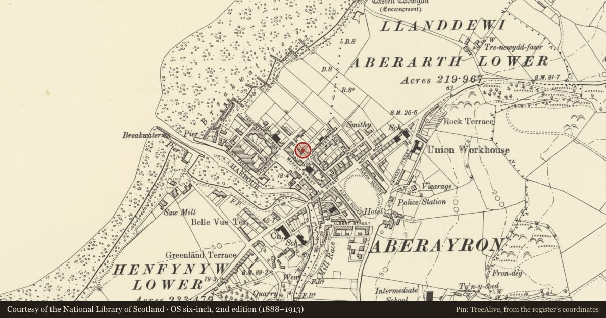
Slide toward Today to fade the historical sheet and see the modern map underneath.
David Rumsey Map Collection, Stanford LibrariesDavid Rumsey Map Collection, Stanford LibrariesDavid Rumsey Map Collection, Stanford LibrariesDavid Rumsey Map Collection, Stanford LibrariesDavid Rumsey Map Collection, Stanford Libraries
5 historical maps cover this location, the earliest the 1830 map "V.3:11-15:XV. Britisches Reich. A. Kon: England. b. Frstenthum Wales: Shire: 37-40" (David Rumsey Map Collection, Stanford Libraries).
Historical maps covering this location
- 1830 · V.3:11-15:XV. Britisches Reich. A. Kon: England. b. Frstenthum Wales: Shire: 37-40 (David Rumsey Map Collection, Stanford Libraries)
- 1898 · 177 Aberaeron (Hills) (David Rumsey Map Collection, Stanford Libraries)
- 1898 · 177 Aberaeron (Outline) (David Rumsey Map Collection, Stanford Libraries)
- 1901 · Sheet 14. (David Rumsey Map Collection, Stanford Libraries)
- 1919 · Sheet 78. Lampeter. (David Rumsey Map Collection, Stanford Libraries)
Cadw's description
Location
Detached and forward to the street, facing down back lane between Queen Street and Victoria Street.
History
Early C19 (shown on ca.1845 Tithe Map).
Exterior
2 storey 3-window whitewashed rubble front; formerly the stables to No 15 Market Street and one of many of its kind in the original town plan of which few survive; modern conversion to living accommodation. Slate roof with 2 rubble stacks. 2 and 3 light recessed casement windows to 1st floor, 12 pane sash windows to ground floor under timber lintels. Some brick rebuilding beside recessed boarded stable door entrance under long timber lintel with deeply recessed windows to right. Rubble end walls.
Reason for designation
Group Value
Nearby in the register
- 1 Victoria StreetDomesticunder 1 mi
- 2 Victoria StreetDomesticunder 1 mi
- 15 Market StreetDomesticunder 1 mi
- 14 Market StreetDomesticunder 1 mi
Other entries of the same register within about three miles of this one, by straight line.