Cof Cymru: National Historic Assets of Wales · Wales
Kelsterton Hall
Connah's Quay, Flintshire, Wales
A Grade II listed building in Kelsterton, Deeside, Connah's Quay, Flintshire, designated on 8 August 1949.
The record
- Designation
- Listed building, Grade II
- Broad class
- Recreational
- Date of designation
- 8 August 1949
- Locality
- Kelsterton
- Town
- Deeside
- Community
- Connah's Quay
- Unitary authority
- Flintshire
- Country
- Wales
- Coordinates
- 53.22854, -3.08246
- Cadw reference
- 1
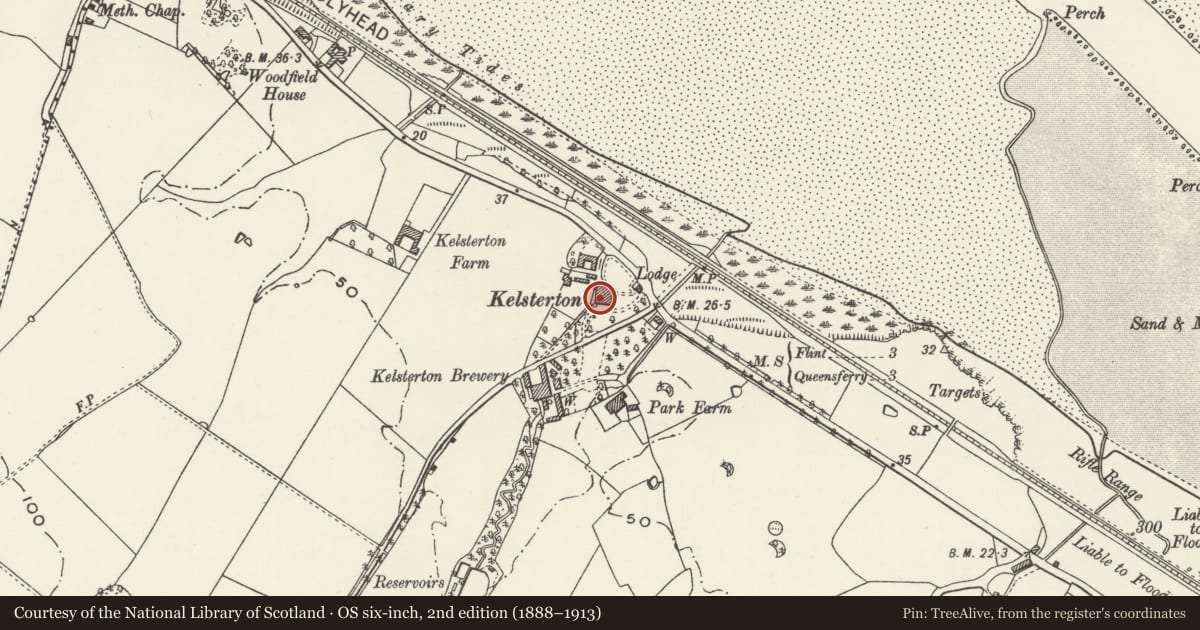
Slide toward Today to fade the historical sheet and see the modern map underneath.
David Rumsey Map Collection, Stanford LibrariesDavid Rumsey Map Collection, Stanford LibrariesDavid Rumsey Map Collection, Stanford LibrariesDavid Rumsey Map Collection, Stanford LibrariesLlyfrgell Genedlaethol Cymru – The National Library of Wales
5 historical maps cover this location, the earliest the 1795 map "To Sir Watkin Williams-Wynn Bart ... the map of the six counties of North Wales is most humbly inscribed by his obedient humble servant" (Llyfrgell Genedlaethol Cymru – The National Library of Wales).
Historical maps covering this location
- 1795 · To Sir Watkin Williams-Wynn Bart ... the map of the six counties of North Wales is most… (Llyfrgell Genedlaethol Cymru – The National Library of Wales)
- 1883 · Watershed map England, Wales 3. (David Rumsey Map Collection, Stanford Libraries)
- 1898 · 108 Flint (Hills) (David Rumsey Map Collection, Stanford Libraries)
- 1898 · 108 Flint (Outline) (David Rumsey Map Collection, Stanford Libraries)
- 1901 · Sheet 9 and 10. (David Rumsey Map Collection, Stanford Libraries)
Cadw's description
Location
Set back slightly from the road at the junction of Kelsterton Road and Kelsterton Lane.
History
Large house of c1800 built for Thomas Bate, owner of Kelsterton Brewery, which opened in 1818 and was the first public brewery in Flintshire.
Exterior
A large 2 storeyed house of red brick with stone dressings. Of 3 bays, the sides advanced and the recess built-up to 2nd storey floor level with later stone pilastered colonnade, now filled in with modern glazing and roofed with glass; this includes a moulded stone entrance with armorial device in pediment. 6 sash windows overall, all with plain key-blocks. Quoins. Coping.
Description not updated at time of survey.
Reason for designation
Listed as a large late-Georgian house retaining its architectural character and detail.
Nearby in the register
- Kelsterton BreweryIndustrial buildingunder 1 mi
- Multi-purpose Farm Building, Top y Fron FarmNo class recordedunder 1 mi
- Top y Fron HallDomesticunder 1 mi
- Kitchen Garden Walls at Top y Fron HallNo class recordedunder 1 mi
Other entries of the same register within about three miles of this one, by straight line.