Historic Buildings Record · Northern Ireland
War memorial
Newtownards, Ards and North Down, Northern Ireland
The record
- Designation
- Record only (not listed)
- Grade
- Record Only
- Type
- Memorial
- Date of construction
- 1920 - 1939
- Address
- War memorial, Court Square, Newtownards, Co. Down, BT23 3NY
- Townland
- Newtownards
- Council
- Ards and North Down
- Country
- Northern Ireland
- Coordinates
- 54.59140, -5.69194
- Date of survey
- 09 September 1998
- HB reference
- HB24/13/047
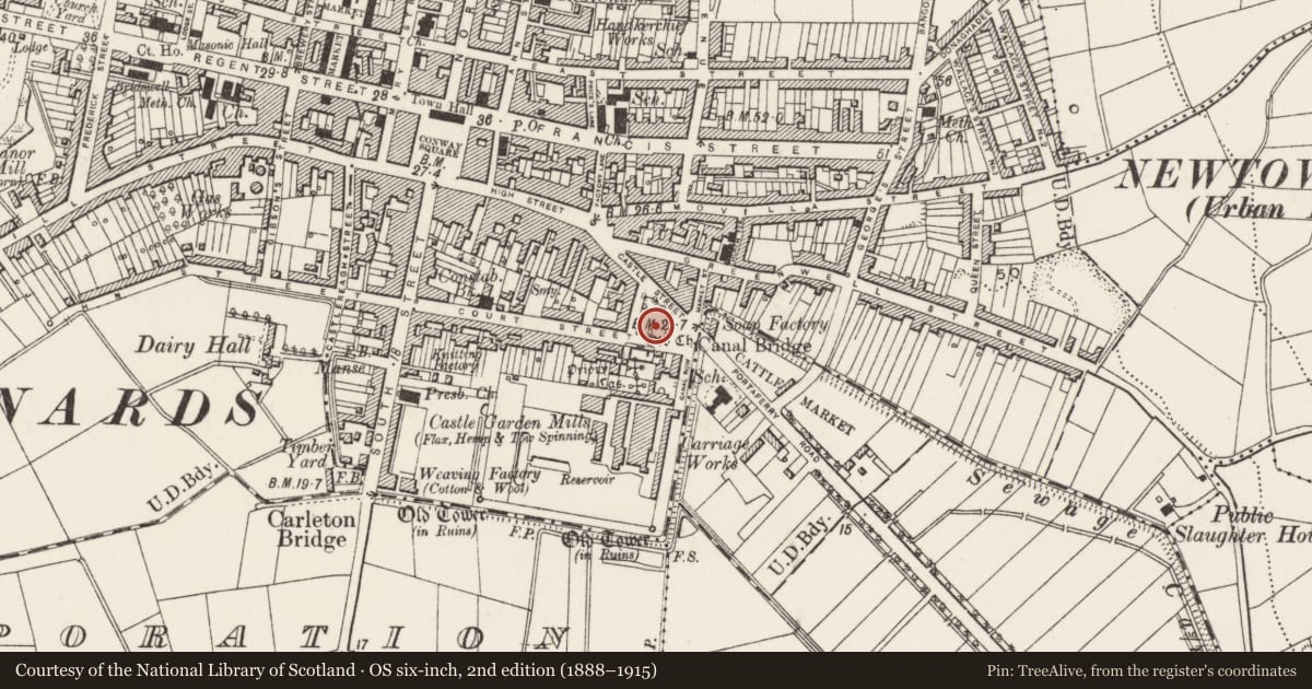
Slide toward Today to fade the historical sheet and see the modern map underneath.
David Rumsey Map Collection, Stanford LibrariesDavid Rumsey Map Collection, Stanford LibrariesDavid Rumsey Map Collection, Stanford Libraries
3 historical maps cover this location, the earliest the 1891 map "Ireland 16" (David Rumsey Map Collection, Stanford Libraries).
Historical maps covering this location
- 1891 · Ireland 16 (David Rumsey Map Collection, Stanford Libraries)
- 1900 · Ireland (David Rumsey Map Collection, Stanford Libraries)
- 1901 · Ireland. (David Rumsey Map Collection, Stanford Libraries)
The Department's description
Exterior description and setting
Granite, obelisk-like war memorial of 1934, situated in the centre of the landscaped Court Square to the SE of Newtownards town centre. The memorial is roughly 7m in height and consists of a square tapering obelisk with shaped head [?was there something once on top], with a panelled surbase and pedestal base beneath, with the whole ensemble resting on a spreading base of four steps.
The N face of the obelisk has a female figure with [?olive] branch in relief [presumably symbolising peace], with a bundle of fasces above with a motif with lion’s head at the very top. The N face of the surbase has a projecting panel with metal letter ‘inscription’, with names of the fallen of the Great War on the other faces of this portion. The pedestal base has a carving of a section of the coat of arms of Newtownards, with the names of the fallen of the Second World War to the other faces of this portion.
This memorial appears to be in good condition and the landscaped square around it is well cared for.
Historical information
Almost three hundred men from the Newtownards area lost their lives in the First World War. In the years following 1918 however, when may other centres were erecting memorials to the fallen, the Newtownards town Council could not agree to spend money on such a monument. In frustration, some ex-servicemen [during a winter in the early 1920s] built their own memorial in the middle of Court Square out of snow, with the inscription ‘Lest we forget’ upon it. Their motive was to shame the council into action, but the police were called and each man fined a shilling for loitering. The protesters, along with other ex-servicemen later proceeded to build their own memorial of wood in the premises in Victoria Avenue. It was not until 1934 that the council finally got around to the construction of this official war memorial.
References- Secondary sources
1 Trevor McCavery 'Newtown: a history of Newtownards' (Dundonald 1994), pp.192-193.
Criteria for listing: architectural interest
Not listed
Criteria for listing: historic interest
Not listed
Evaluation
A granite obelisk-like war memorial erected in 1934 to commemorate the fallen of the Great War. Set in a beautifully managed garden of rememberance, this structure, whilst not sufficiently unusual to merit listing, is of considerable local significance.
Nearby in the register
- 6-9 Court SquareDemolishedunder 1 mi
- 4 COURT SQUARE NEWTOWNARDS CO. DOWNHOUSEunder 1 mi
- 5 COURT SQUARE NEWTOWNARDS CO. DOWNHOUSEunder 1 mi
- 2-3 Court SquareDemolishedunder 1 mi
Other entries of the same register within about three miles of this one, by straight line.