Historic Buildings Record · Northern Ireland
’Drift Inn’ Bar
Donaghadee, Ards and North Down, Northern Ireland
The record
- Designation
- Record only (not listed)
- Grade
- Record Only
- Type
- Demolished
- Date of listing
- 5 May 1982
- Date of delisting
- 26 May 1995
- Address
- ’Drift Inn’ Bar, Manor Street, Donaghadee, Co Down
- Townland
- Donaghadee
- Council
- Ards and North Down
- Country
- Northern Ireland
- Coordinates
- 54.64279, -5.53255
- Date of survey
- 08 May 1998
- HB reference
- HB24/07/012
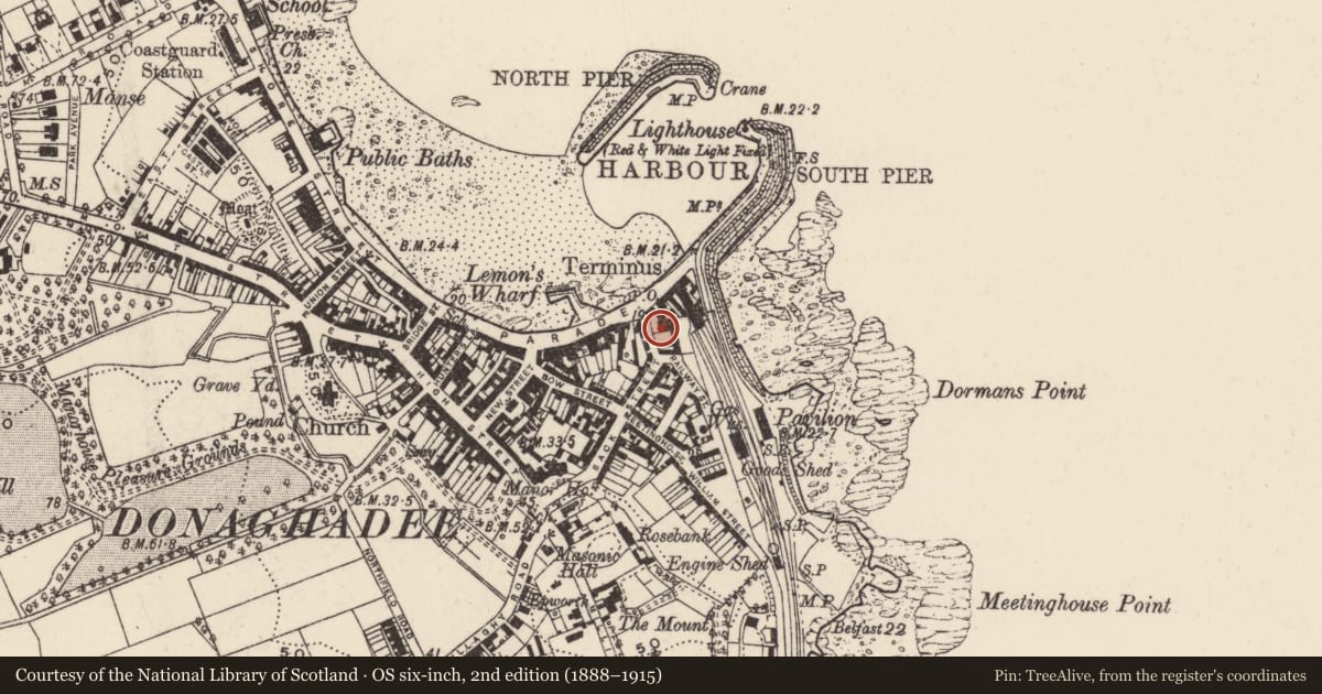
Slide toward Today to fade the historical sheet and see the modern map underneath.
David Rumsey Map Collection, Stanford LibrariesDavid Rumsey Map Collection, Stanford LibrariesDavid Rumsey Map Collection, Stanford LibrariesDavid Rumsey Map Collection, Stanford Libraries
4 historical maps cover this location, the earliest the 1690 map "Scotland below the Tay." (David Rumsey Map Collection, Stanford Libraries).
Historical maps covering this location
- 1690 · Scotland below the Tay. (David Rumsey Map Collection, Stanford Libraries)
- 1697 · Scotia, Parte Meridionale (David Rumsey Map Collection, Stanford Libraries)
- 1794 · Sheet 55. (Cary's England, Wales, and Scotland). (David Rumsey Map Collection, Stanford Libraries)
- 1841 · Scotland (Southern part). XIII (David Rumsey Map Collection, Stanford Libraries)
The Department's description
Exterior description and setting
Site (at the N end of Manor Street near the Parade) of a former public house of probable early nineteenth century origin, demolished c.1994, with site still empty.
This building was described in 1977 as a ‘substantial two storey, late Georgian house...[with] central doorway with fine elliptical arch fanlight...flanked by wide canted bays which rise to pyramidal roofs’.
Historical information
The town plan of Donaghadee, drawn up to accompany the valuation records of c.1836, shows the former house on this site with its canted bays. At this stage the building is noted as part of the estate ‘of the late R. Halliday’ with a rateable value of £34. With the coming of the railway to Donaghadee in 1860/1 (the line ended just to the NE of this site) the property became the Railway Hotel and latterly served as a public house. The building was demolished c.1994.
References- Primary sources
1. PRONI VAL 1B/32 pp.9 1st valuation, Donaghadee parish, Donaghadee., c.1836. [See also accompanying town plan.]
2. PRONI OS Maps 1st rev. 1858-60, Co. Down 3.
3. PRONI 2nd (‘Griffith’s’) valuation Donaghadee parish, Donaghadee, 1863. [The town plan for the 2nd valuation is not available at PRONI and therefore it is difficult to match the properties listed in the valuation with actual buildings.]
Secondary sources
1. Hugh Dixon et al Historic buildings, groups of buildings, buildings of architectural importance in Donaghadee and Portpatrick (UAHS 1977), p.25.
Criteria for listing: architectural interest
Not listed
Criteria for listing: historic interest
Not listed
Evaluation
Site of former house (latterly a public house) dating from c.1830, demolished c.1994 with site still vacant.
Nearby in the register
- 37 The ParadeRecreational clubunder 1 mi
- 28 The ParadeHouseunder 1 mi
- Harbour HouseHouseunder 1 mi
- 26 The ParadeShopunder 1 mi
Other entries of the same register within about three miles of this one, by straight line.