Historic Buildings Record · Northern Ireland
Knocknagoney Lodge
Belfast, Northern Ireland
The record
- Designation
- Record only (not listed)
- Grade
- Record Only
- Type
- No type recorded
- Address
- Knocknagoney Lodge, Belfast Road, Knocknagoney, Belfast, County Down
- Council
- Belfast
- Country
- Northern Ireland
- Coordinates
- 54.62035, -5.85954
- Date of survey
- 06 January 2010
- HB reference
- HB23/17/009
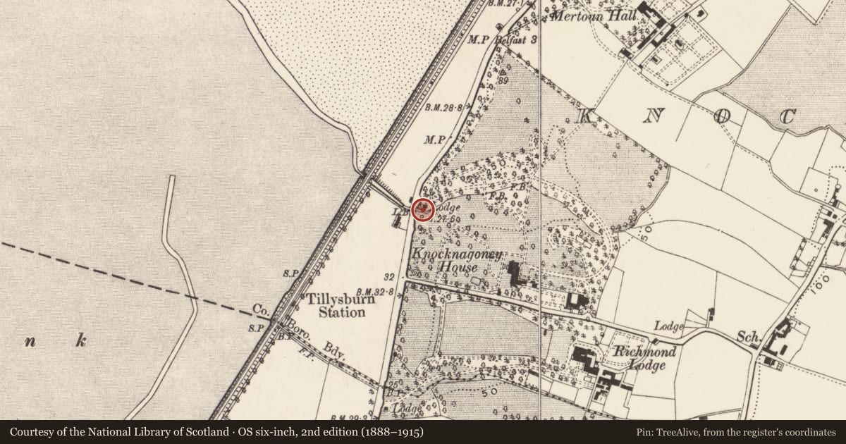
Slide toward Today to fade the historical sheet and see the modern map underneath.
David Rumsey Map Collection, Stanford LibrariesDavid Rumsey Map Collection, Stanford LibrariesDavid Rumsey Map Collection, Stanford LibrariesDavid Rumsey Map Collection, Stanford Libraries
4 historical maps cover this location, the earliest the 1636 map "Vltoniae Orientalis Pars" (David Rumsey Map Collection, Stanford Libraries).
Historical maps covering this location
- 1636 · Vltoniae Orientalis Pars (David Rumsey Map Collection, Stanford Libraries)
- 1794 · Sheet 55. (Cary's England, Wales, and Scotland). (David Rumsey Map Collection, Stanford Libraries)
- 1811 · Ireland. (David Rumsey Map Collection, Stanford Libraries)
- 1891 · Ireland 16 (David Rumsey Map Collection, Stanford Libraries)
The Department's description
Exterior description and setting
The lodge has been demolished and a car-park is now located on the site.
The First Survey card states:
'Single/sty gate lodge with back basement. Slate roof, central valley, gable ends. Projecting & mld. verges. Rendered chimneys set diagonally. Walls rendered, lined & painted. Mld base. N. front has central gabled porch. Mld. roundel in tympanum. Entrance doorway has label mldg. & sheeted door. On each side face of porch are narrow windows top hung & label mldg. On each side of porch a casement window with label mldg. 2 same windows on E. face of lodge. N. face about 25 ft. Condition fair.
former gate lodge to house now known as Windsor Hotel. Suggest mid 19c.'
Historical information
N/A
Criteria for listing: architectural interest
Not listed
Criteria for listing: historic interest
Not listed
Evaluation
The lodge has been demolished and a car-park is now located on the site.
General comments
Partial Survey Only
Nearby in the register
- ParklandsHouseunder 1 mi
- ParklandsHouseunder 1 mi
- ParklandsHouseunder 1 mi
- Mertoun HallHOUSEunder 1 mi
Other entries of the same register within about three miles of this one, by straight line.