Historic Buildings Record · Northern Ireland
Whiteabbey Railway Station
Antrim and Newtownabbey, Northern Ireland
The record
- Designation
- Record only (not listed)
- Grade
- Record Only
- Type
- No type recorded
- Address
- Whiteabbey Railway Station, Station Road, Whiteabbey, Newtownabbey, Co Antrim, BT37 0AQ
- Council
- Antrim and Newtownabbey
- Country
- Northern Ireland
- Coordinates
- 54.67217, -5.90425
- Date of survey
- 16 October 2008
- HB reference
- HB21/09/001
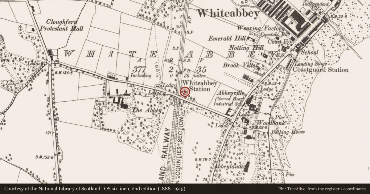
Slide toward Today to fade the historical sheet and see the modern map underneath.
David Rumsey Map Collection, Stanford LibrariesDavid Rumsey Map Collection, Stanford LibrariesDavid Rumsey Map Collection, Stanford LibrariesDavid Rumsey Map Collection, Stanford Libraries
4 historical maps cover this location, the earliest the 1636 map "Vltoniae Orientalis Pars" (David Rumsey Map Collection, Stanford Libraries).
Historical maps covering this location
- 1636 · Vltoniae Orientalis Pars (David Rumsey Map Collection, Stanford Libraries)
- 1697 · Scotia, Parte Meridionale (David Rumsey Map Collection, Stanford Libraries)
- 1811 · Ireland. (David Rumsey Map Collection, Stanford Libraries)
- 1891 · Ireland 16 (David Rumsey Map Collection, Stanford Libraries)
The Department's description
Exterior description and setting
Multi-bay single-storey railway station, built c.1850. Pitched roof with deep overhanging eaves; red brick walling with yellow brick dressings; round-arched-headed windows. The building was not listed during the First Survey and has since been demolished.
The First Survey card records:
'A long single storey red brick range with a two-storey block to the north end. Yellow brick trim around openings which have now been closed up. Facing this across on the other side of track is a platform shelter from the B.D.Wise era red brick with timber framing and a big overhanging roof on an interesting truss system. Fretted barge boards. Also a stone bridge over the railway at north end of platforms
Station built 1863-4 but the waiting room accommodation on down platform is later, probably 1890s. (W A McCutcheon The Ind Archaeology of NI p166)'
Historical information
N/A
Criteria for listing: architectural interest
Not listed
Criteria for listing: historic interest
Not listed
Evaluation
Building demolished
Nearby in the register
- Abbey HouseOfficeunder 1 mi
- Immaculata Special School,No type recordedunder 1 mi
- WoodbankHouseunder 1 mi
- Fernagh EstateNo type recordedunder 1 mi
Other entries of the same register within about three miles of this one, by straight line.