Historic Buildings Record · Northern Ireland
1 & 3 Castle Street
Town Parks, Antrim and Newtownabbey, Northern Ireland
The record
- Designation
- Record only (not listed)
- Grade
- Record Only
- Type
- Demolished
- Date of construction
- 1880 - 1899
- Address
- 1 & 3 Castle Street, Antrim
- Townland
- Town Parks
- Council
- Antrim and Newtownabbey
- Country
- Northern Ireland
- Coordinates
- 54.71588, -6.22123
- Date of survey
- 06 November 2004
- HB reference
- HB20/08/046
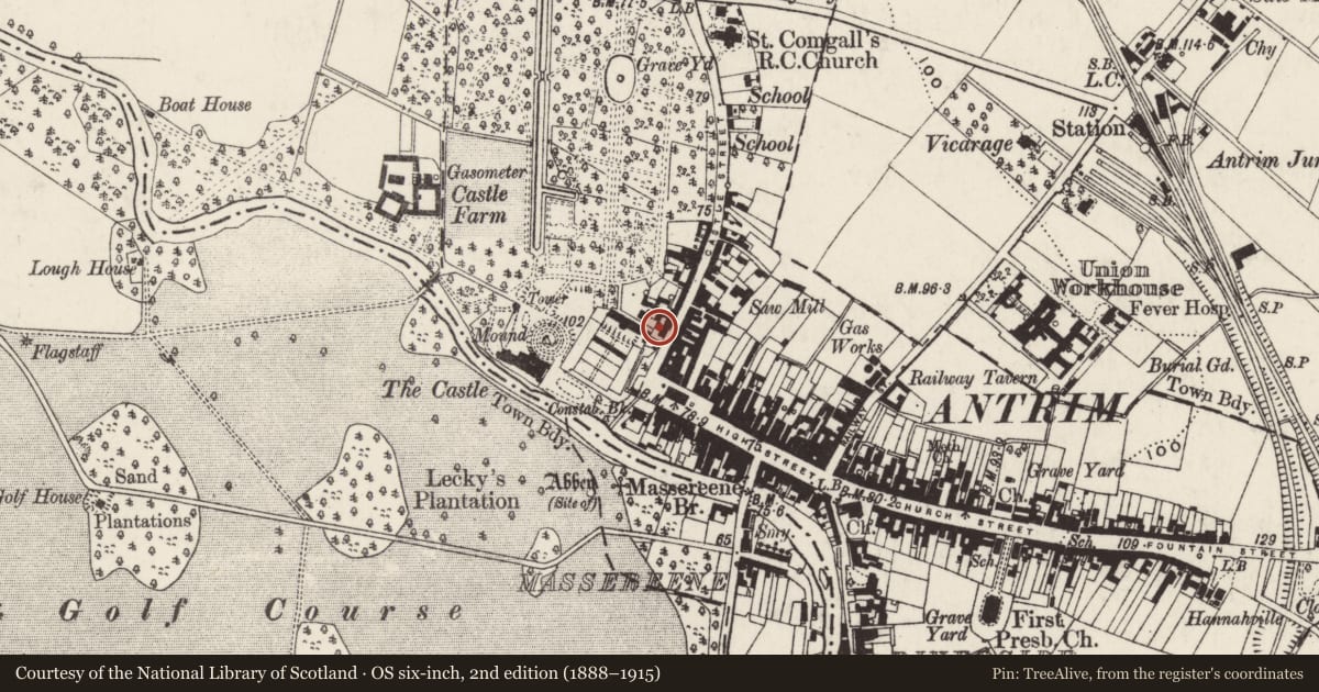
Slide toward Today to fade the historical sheet and see the modern map underneath.
David Rumsey Map Collection, Stanford LibrariesDavid Rumsey Map Collection, Stanford LibrariesDavid Rumsey Map Collection, Stanford LibrariesDavid Rumsey Map Collection, Stanford Libraries
4 historical maps cover this location, the earliest the 1869 map "Ireland." (David Rumsey Map Collection, Stanford Libraries).
Historical maps covering this location
- 1869 · Ireland. (David Rumsey Map Collection, Stanford Libraries)
- 1881 · Ireland to Illustrate the Military Condition of the Country. (David Rumsey Map Collection, Stanford Libraries)
- 1883 · Scotland. (David Rumsey Map Collection, Stanford Libraries)
- 1891 · Ireland 16 (David Rumsey Map Collection, Stanford Libraries)
The Department's description
Exterior description and setting
Demolished to make way for a car park.
Described in the first survey in 1970 as "A pair of cottages built of coursed rubble blackstone with blue brick block dressings to plain sashed windows and doors. Upper windows are set in half dormers; all roofs are slated with cresting on ridges. Chimneys are of red brick. The entrances are contained in projecting porches; slated doors are surmounted by horizontal lattice paned fanlights."
Historical information
Precise date of buildings not recorded but stylistically they may be dated to the late Victorian period.
References – Primary Sources
1. OS Map 1962, Co Antrim 50.
Secondary Sources
1. UAHS, Antrim and Ballymena (Belfast, 1969), p 10.
2. J. Hanna, Old Antrim (Catrine, Ayrshire, 2002), p 17 (the south gable of the block appears in an old photograph of Castle Street).
Criteria for listing: architectural interest
Not listed
Criteria for listing: historic interest
Not listed
Evaluation
Demolished to make way for a car park.
Nearby in the register
- 5-9 Castle StreetDemolishedunder 1 mi
- Rampart and BastionWallingunder 1 mi
- 2 & 4 Castle StreetDemolishedunder 1 mi
- Castle BarDemolishedunder 1 mi
Other entries of the same register within about three miles of this one, by straight line.