Historic Buildings Record · Northern Ireland
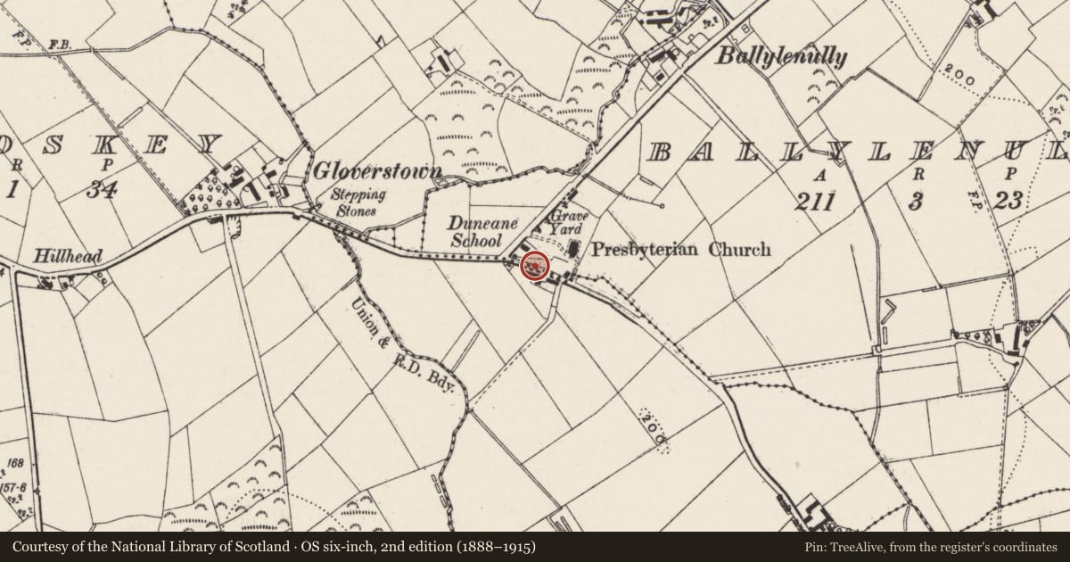
81 Gloverstown Road
Antrim and Newtownabbey, Northern Ireland
The record
- Designation
- Record only (not listed)
- Grade
- Record Only
- Type
- No type recorded
- Address
- 81 Gloverstown Road, Ballylenully, Toomebridge, Co. Antrim, BT41 3RB, ** See general comments**
- Council
- Antrim and Newtownabbey
- Country
- Northern Ireland
- Coordinates
- 54.75048, -6.41461
- Date of survey
- 02 September 2008
- HB reference
- HB20/01/012
Slide toward Today to fade the historical sheet and see the modern map underneath.
David Rumsey Map Collection, Stanford LibrariesDavid Rumsey Map Collection, Stanford LibrariesDavid Rumsey Map Collection, Stanford LibrariesDavid Rumsey Map Collection, Stanford Libraries
4 historical maps cover this location, the earliest the 1636 map "Vltoniae Orientalis Pars" (David Rumsey Map Collection, Stanford Libraries).
Historical maps covering this location
- 1636 · Vltoniae Orientalis Pars (David Rumsey Map Collection, Stanford Libraries)
- 1841 · Ireland. (David Rumsey Map Collection, Stanford Libraries)
- 1869 · Ireland. (David Rumsey Map Collection, Stanford Libraries)
- 1891 · Ireland 16 (David Rumsey Map Collection, Stanford Libraries)
The Department's description
Exterior description and setting
A detached multi-bay two-storey vernacular farmhouse, built c.1850, located to south of Gloverstown Road, opposite Duneane Presbyterian Church (HB20/01/19A). The structure first appeared on the 1857 OS map. Although the house has retained its original plan form, original roof, fenestration and doors have been lost since the structure was noted during the 1970s First Survey. Window spacing has also been altered and the house has been re-rendered with modern decorative elements added that are unsympathetic to the original farmhouse.
Historical information
Partial survey only. Building surveyed in first survey but not deemed worthy of a full second survey
Criteria for listing: architectural interest
Not listed
Criteria for listing: historic interest
Not listed
Evaluation
Partial survey only. Building surveyed in first survey but not deemed worthy of a full second survey
General comments
Partial survey only. Building surveyed in first survey but not deemed worthy of a full second survey
Nearby in the register
- Duneane Presbyterian ChurchChurchunder 1 mi
- Hall (Former Church), Duneane Presbyterian Church, Gloverstown Road, Toomebridge, Co Antrim, BT41 3RBHallunder 1 mi
- Carey Memorial,Memorialunder 1 mi
- Duneane Parish ChurchChurchunder 1 mi
Other entries of the same register within about three miles of this one, by straight line.