Historic Buildings Record · Northern Ireland
Belmount Weaving Factory
Armagh City, Banbridge and Craigavon, Northern Ireland
The record
- Designation
- Record only (not listed)
- Grade
- Record Only
- Type
- No type recorded
- Address
- Belmount Weaving Factory, Rathfriland Road, Banbridge, Co Down, BT32 4LH
- Council
- Armagh City, Banbridge and Craigavon
- Country
- Northern Ireland
- Coordinates
- 54.34435, -6.26321
- Date of survey
- 02 December 2012
- HB reference
- HB17/07/030
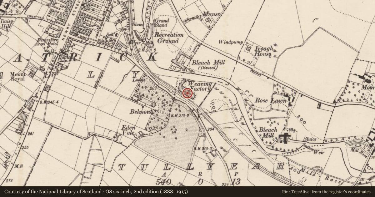
Slide toward Today to fade the historical sheet and see the modern map underneath.
David Rumsey Map Collection, Stanford LibrariesDavid Rumsey Map Collection, Stanford LibrariesDavid Rumsey Map Collection, Stanford LibrariesDavid Rumsey Map Collection, Stanford Libraries
4 historical maps cover this location, the earliest the 1636 map "Vltoniae Orientalis Pars" (David Rumsey Map Collection, Stanford Libraries).
Historical maps covering this location
- 1636 · Vltoniae Orientalis Pars (David Rumsey Map Collection, Stanford Libraries)
- 1811 · Ireland. (David Rumsey Map Collection, Stanford Libraries)
- 1841 · Ireland. (David Rumsey Map Collection, Stanford Libraries)
- 1891 · Ireland 16 (David Rumsey Map Collection, Stanford Libraries)
The Department's description
Exterior description and setting
A former weaving factory of rubble stone with brick dressings and red brick chimney, now demolished.
The First Survey card records:
‘‘Post 1861. 2 - storey dwelling & office, single storey sheds. Slated roofs. Greystone walls with brick dressings. 290' frontage. Poor condition.
Built by Robert McClelland as weaving factory, occupied by Todd Bros. & now used for fowl.
Industrial Archaeology of Co Down E.R.R. Green.
Date of visit: 15th September 1969 ‘
Historical information
N/A
Criteria for listing: architectural interest
Not listed
Criteria for listing: historic interest
Not listed
Evaluation
A former weaving factory of rubble stone with brick dressings and red brick chimney, now demolished.
General comments
Partial Survey Only
Nearby in the register
- Belmont HotelHOTELunder 1 mi
- GatelodgeGates/ Screens/ Lodgesunder 1 mi
- Old BreweryNo type recordedunder 1 mi
- 63-71 Castlewellan RoadNo type recordedunder 1 mi
Other entries of the same register within about three miles of this one, by straight line.