Historic Buildings Record · Northern Ireland
83 Milltown Road
Armagh City, Banbridge and Craigavon, Northern Ireland
The record
- Designation
- Record only (not listed)
- Grade
- Record Only
- Type
- No type recorded
- Address
- 83 Milltown Road, Banbridge, Co Down, BT63 3SY
- Council
- Armagh City, Banbridge and Craigavon
- Country
- Northern Ireland
- Coordinates
- 54.43765, -6.27730
- Date of survey
- 28 March 2012
- HB reference
- HB17/02/004
Slide toward Today to fade the historical sheet and see the modern map underneath.
David Rumsey Map Collection, Stanford LibrariesDavid Rumsey Map Collection, Stanford LibrariesDavid Rumsey Map Collection, Stanford LibrariesDavid Rumsey Map Collection, Stanford Libraries
4 historical maps cover this location, the earliest the 1636 map "Vltoniae Orientalis Pars" (David Rumsey Map Collection, Stanford Libraries).
Historical maps covering this location
- 1636 · Vltoniae Orientalis Pars (David Rumsey Map Collection, Stanford Libraries)
- 1811 · Ireland. (David Rumsey Map Collection, Stanford Libraries)
- 1841 · Ireland. (David Rumsey Map Collection, Stanford Libraries)
- 1891 · Ireland 16 (David Rumsey Map Collection, Stanford Libraries)
The Department's description
Exterior description and setting
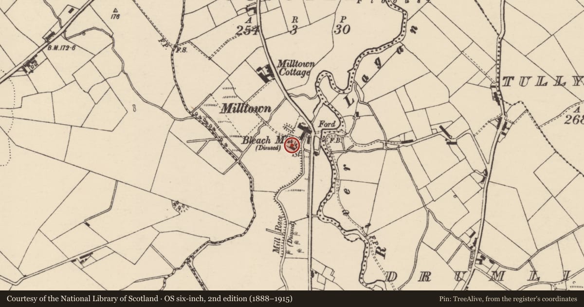
A former bleachworks now demolished and redeveloped as housing.
The First Survey card records:
‘c.1835. Three and four storey blocks with office buildings. Various types of construction are employed for walls, roofs are slated. There are several small pane windows on G.F. of 3-storey block, remainder of windows are D/H with single vertical g.b. Part is now used for storage of potatoes. Condition of buildings is poor.
This was the greatest bleachworks on the Bann, output of 40,000 pieces in 1839 was largest in Co. Down. In 1863, 120,000 pieces of 30 yards each could be handled per annum. Power was provided by 2 iron breast wheels and 2 steam engines. Smyths, the owners, opened an iron works across river in 1876 (now demolished). Bleaching stopped in 1930’s. Stripped after Second World War
Smaller “bleach mill” appears on O.S. map of 1833
Industrial Archaeology of Co. Down. E.R.R. Green.
Date of visit: 7th October 1969
Historical information
N/A
Criteria for listing: architectural interest
Not listed
Criteria for listing: historic interest
Not listed
Evaluation
A former bleachworks comprising three- and four-storey blocks with office buildings; various types of construction.
General comments
Partial Survey Only
Nearby in the register
- GEEHAN'S BRIDGE EDENBALLYCOGGIL/DRUMLINBRIDGEunder 1 mi
- 98 Dromore RoadHouseunder 1 mi
- MOOREFIELDHouseunder 1 mi
- CAMBRAY HOUSEHOUSEunder 1 mi
Other entries of the same register within about three miles of this one, by straight line.