Historic Buildings Record · Northern Ireland
Old St. Colman’s Hall
Ballynacraig, Newry, Mourne and Down, Northern Ireland
The record
- Designation
- Record only (not listed)
- Grade
- Record Only
- Type
- Demolished
- Date of construction
- 1700 - 1719
- Address
- Old St. Colman’s Hall, St. Colman’s Place, Newry, Co Down
- Townland
- Ballynacraig
- Council
- Newry, Mourne and Down
- Country
- Northern Ireland
- Coordinates
- 54.17269, -6.33652
- Date of survey
- 11 August 1997
- HB reference
- HB16/30/008
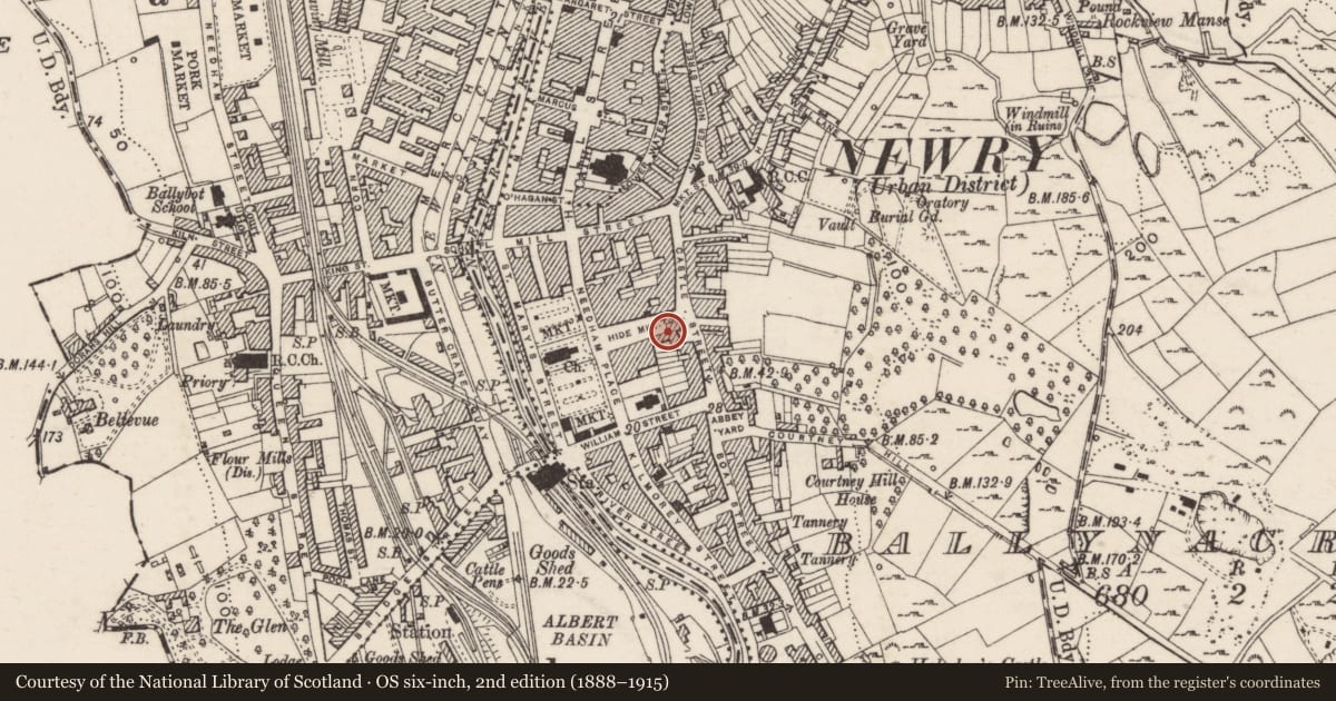
Slide toward Today to fade the historical sheet and see the modern map underneath.
David Rumsey Map Collection, Stanford LibrariesDavid Rumsey Map Collection, Stanford LibrariesDavid Rumsey Map Collection, Stanford LibrariesUniversity Library, Vrije Universiteit Amsterdam
4 historical maps cover this location, the earliest the 1636 map "Vltoniae Orientalis Pars" (David Rumsey Map Collection, Stanford Libraries).
Historical maps covering this location
- 1636 · Vltoniae Orientalis Pars (David Rumsey Map Collection, Stanford Libraries)
- 1637 · The Fourth table of Ireland. Ultonia Oriental (David Rumsey Map Collection, Stanford Libraries)
- 1753 · Mappa geographica Regni Hiberniae (David Rumsey Map Collection, Stanford Libraries)
- Sheet 11 The Mourne Mountains (University Library, Vrije Universiteit Amsterdam)
The Department's description
Exterior description and setting
Former market house demolished to make way for new road.
Described in the first survey in 1969 as 'Pre-1735 building built of rubble with dressed stone quoins, part rendered and part roughcast. Façade to Castle Street is 2-storeys high, rear of building is topped by pinnacled gablet and extends sharply down St Colman's Park. Cornice & parapet to front elevation, which contains 2 partly blocked semi-circular headed voussoired window opes and 2 sq. headed door opes, 1st floor contains 4 sq. headed window opes. Derelict.'
Historical information
History as given on first survey card 'Once known as Home Rule Hall. Used as jail, market house, Irish Volunteer and Yeomanry hall and school. Great public figures addressed large gatherings.'
Criteria for listing: architectural interest
Not listed
Criteria for listing: historic interest
Not listed
Evaluation
Demolished to make way for road.
Nearby in the register
- 7 St. Colman’s ParkOfficeunder 1 mi
- 9 St. Colman’s ParkOfficeunder 1 mi
- 11 St. Colman’s ParkHouse - Terraceunder 1 mi
- 13 St. Colman’s ParkOfficeunder 1 mi
Other entries of the same register within about three miles of this one, by straight line.