Historic Buildings Record · Northern Ireland
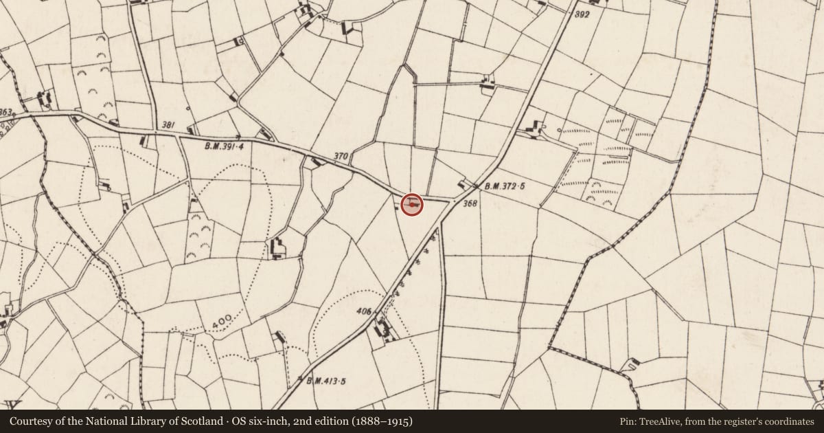
Site on Bog Road near junction of Cross Road
Ballygorian More, Newry, Mourne and Down, Northern Ireland
The record
- Designation
- Record only (not listed)
- Grade
- Record Only
- Type
- Demolished
- Date of construction
- 1840 - 1859
- Address
- Site on Bog Road near junction of Cross Road, Rathfriland, Newry, Co Down, BT34 5DT
- Townland
- Ballygorian More
- Council
- Newry, Mourne and Down
- Country
- Northern Ireland
- Coordinates
- 54.21117, -6.17110
- Date of survey
- 24 June 1999
- HB reference
- HB16/09/002
Slide toward Today to fade the historical sheet and see the modern map underneath.
David Rumsey Map Collection, Stanford LibrariesDavid Rumsey Map Collection, Stanford LibrariesDavid Rumsey Map Collection, Stanford LibrariesDavid Rumsey Map Collection, Stanford Libraries
4 historical maps cover this location, the earliest the 1838 map "Ireland, north sheet." (David Rumsey Map Collection, Stanford Libraries).
Historical maps covering this location
- 1838 · Ireland, north sheet. (David Rumsey Map Collection, Stanford Libraries)
- 1841 · Ireland. (David Rumsey Map Collection, Stanford Libraries)
- 1848 · Ireland. (David Rumsey Map Collection, Stanford Libraries)
The Department's description
Exterior description and setting
Original building now demolished. New house on the site.
Historical information
First shown on 1860 OS 6” map and captioned “National School”. Original HMBB survey card states: “Mid C19. A single-storey building with harled and whitewashed walls. Chimneys – one rendered and roof is slated. There are three D/H (double hung) windows with full G/B (glazing bars) either side. A lean-to porch has two windows with vertical G/B, these appears to be a late insertion. The building resembles a small school.”
Primary Sources:
1. OS 6" map, 2nd edition (1860) Co Down sheet 47 (PRONI OS 6/3/47/2)
2. HMBB survey card dated 12/01/1970.
Criteria for listing: architectural interest
Not listed
Criteria for listing: historic interest
Not listed
Evaluation
Original building on this site has been demolished and replaced with a modern bungalow.
Nearby in the register
- 17 Cross RoadHouseunder 1 mi
- 25 Bog RoadHouseunder 1 mi
- 17 Drumlough School RoadHouseunder 1 mi
- Former mill complexMillunder 1 mi
Other entries of the same register within about three miles of this one, by straight line.