Historic Buildings Record · Northern Ireland
48 MAIN ST.
Armagh City, Banbridge and Craigavon, Northern Ireland
The record
- Designation
- Listed building, Grade B1
- Grade
- B1
- Type
- SHOP
- Date of listing
- 10 September 1980
- Address
- 48 MAIN ST., LOUGHGALL, CO.ARMAGH
- Council
- Armagh City, Banbridge and Craigavon
- Country
- Northern Ireland
- Coordinates
- 54.41010, -6.60155
- HB reference
- HB15/02/013 A
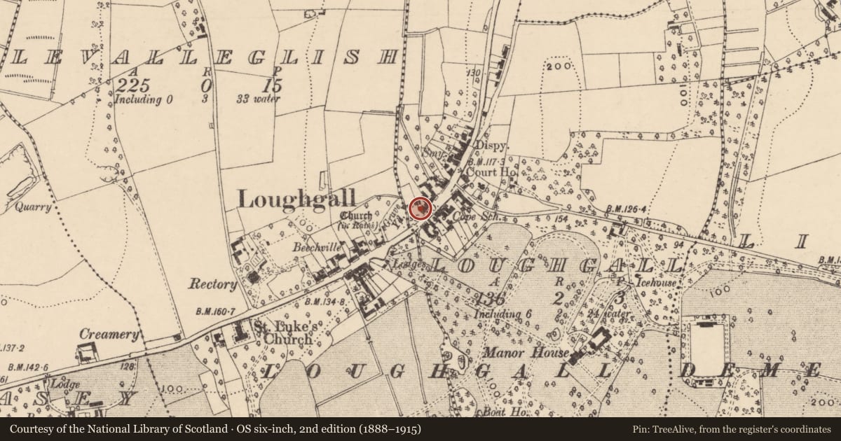
Slide toward Today to fade the historical sheet and see the modern map underneath.
David Rumsey Map Collection, Stanford LibrariesDavid Rumsey Map Collection, Stanford LibrariesDavid Rumsey Map Collection, Stanford LibrariesDavid Rumsey Map Collection, Stanford Libraries
4 historical maps cover this location, the earliest the 1636 map "Vltoniae Orientalis Pars" (David Rumsey Map Collection, Stanford Libraries).
Historical maps covering this location
- 1636 · Vltoniae Orientalis Pars (David Rumsey Map Collection, Stanford Libraries)
- 1790 · Composite: Ireland. (David Rumsey Map Collection, Stanford Libraries)
- 1869 · Ireland. (David Rumsey Map Collection, Stanford Libraries)
- 1891 · Ireland 16 (David Rumsey Map Collection, Stanford Libraries)
The Department's description
Historical information
Precise date of building not recorded but the terrace of which it is part appears on the OS map of 1860; it may be taken to date from the mid-19th century.
References – Primary Sources
1. OS Map 1860, Co Armagh 8.
Secondary Sources
1. DOENI, Loughgall: A Conservation Village (Belfast, 1993), p 28.
Nearby in the register
- 50 MAIN ST.HOUSEunder 1 mi
- 52 MAIN ST.HOUSEunder 1 mi
- 54 MAIN ST.HOUSEunder 1 mi
- 56 MAIN ST.SHOPunder 1 mi
Other entries of the same register within about three miles of this one, by straight line.