Historic Buildings Record · Northern Ireland
Desertoghill Church Ruins
Causeway Coast and Glens, Northern Ireland
The record
- Designation
- Record only (not listed)
- Grade
- Record Only
- Type
- Graveyard
- Address
- Desertoghill Church Ruins, Kurin Road, Coleraine, Co. Londonderry
- Council
- Causeway Coast and Glens
- Country
- Northern Ireland
- Coordinates
- 54.97282, -6.67228
- Date of survey
- 30 October 2012
- HB reference
- HB03/02/032
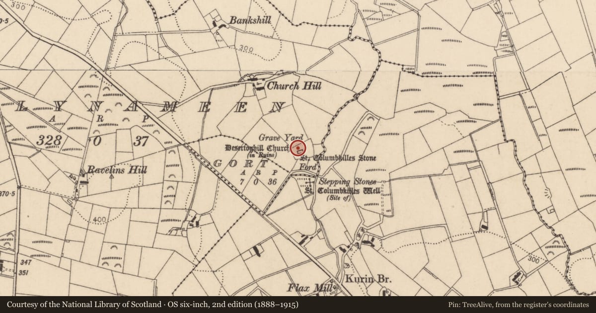
Slide toward Today to fade the historical sheet and see the modern map underneath.
David Rumsey Map Collection, Stanford LibrariesDavid Rumsey Map Collection, Stanford LibrariesDavid Rumsey Map Collection, Stanford LibrariesDavid Rumsey Map Collection, Stanford Libraries
4 historical maps cover this location, the earliest the 1881 map "Ireland to Illustrate the Military Condition of the Country." (David Rumsey Map Collection, Stanford Libraries).
Historical maps covering this location
- 1881 · Ireland to Illustrate the Military Condition of the Country. (David Rumsey Map Collection, Stanford Libraries)
- 1883 · Scotland. (David Rumsey Map Collection, Stanford Libraries)
- 1891 · Ireland 16 (David Rumsey Map Collection, Stanford Libraries)
- 1900 · Ireland (David Rumsey Map Collection, Stanford Libraries)
The Department's description
Exterior description and setting
This building was surveyed in the First Survey but not listed. A partial record only was taken during the Second Survey as the building is not worthy of a full survey.
Rubblestone remains of a late medieval church, located in a cemetery on Kurin Road, Coleraine.
Criteria for listing: architectural interest
Not listed
Criteria for listing: historic interest
Not listed
Evaluation
This building was surveyed in the First Survey but not listed. A partial record only was taken during the Second Survey as the building is not worthy of a full survey.
Rubblestone remains of a late medieval church, located in a cemetery on Kurin Road, Coleraine.
General comments
This building was surveyed in the First Survey but not listed. A partial record only was taken during the Second Survey as the building is not worthy of a full survey.
Rubblestone remains of a late medieval church, located in a cemetery on Kurin Road, Coleraine.
Nearby in the register
- 38 Kilrea RoadFarm Buildingsunder 1 mi
- 7 Fort RoadHouseunder 1 mi
- Ballynameen BridgeBridgeunder 1 mi
- St Paul's ChurchChurchunder 1 mi
Other entries of the same register within about three miles of this one, by straight line.