Historic Buildings Record · Northern Ireland
Stone Cross
Carnanbane, Causeway Coast and Glens, Northern Ireland
The record
- Designation
- Record only (not listed)
- Grade
- Record Only
- Type
- Memorial
- Date of construction
- Pre 1600
- Address
- Stone Cross, Carnanbane Road, Carnanbane TD, Dungiven, Co Londonderry
- Townland
- Carnanbane
- Council
- Causeway Coast and Glens
- Country
- Northern Ireland
- Coordinates
- 54.90288, -6.94888
- Date of survey
- 31 July 2000
- HB reference
- HB02/05/046
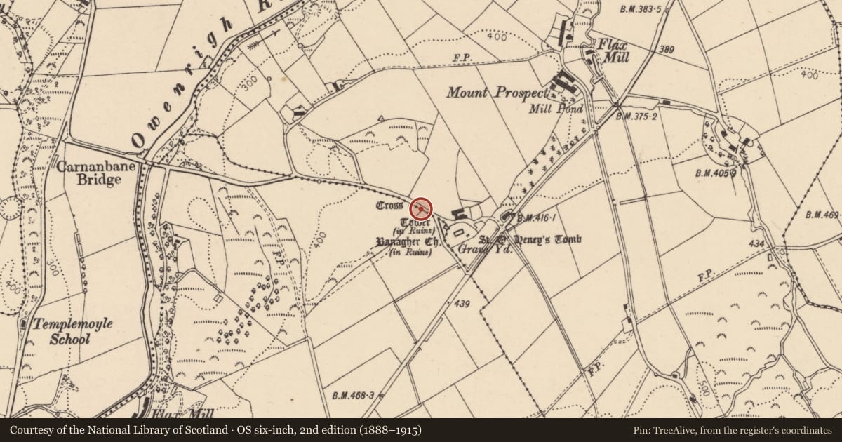
Slide toward Today to fade the historical sheet and see the modern map underneath.
David Rumsey Map Collection, Stanford LibrariesDavid Rumsey Map Collection, Stanford LibrariesDavid Rumsey Map Collection, Stanford LibrariesDavid Rumsey Map Collection, Stanford Libraries
4 historical maps cover this location, the earliest the 1881 map "Ireland to Illustrate the Military Condition of the Country." (David Rumsey Map Collection, Stanford Libraries).
Historical maps covering this location
- 1881 · Ireland to Illustrate the Military Condition of the Country. (David Rumsey Map Collection, Stanford Libraries)
- 1891 · Ireland 16 (David Rumsey Map Collection, Stanford Libraries)
- 1900 · Ireland (David Rumsey Map Collection, Stanford Libraries)
- 1922 · Ireland - northern section. (David Rumsey Map Collection, Stanford Libraries)
The Department's description
Exterior description and setting
A stone cross inside the W ditch of Carnanbane Road near Banagher old church.
A 1000mm high rough stone cross, much eroded with cross arms measuring 510mm overall. The face of the upright has a width of 250mm and the thickness varies because of erosion, roughly 100mm. There is a repair joint on the vertical shaft. The cross is mounted on top of ditch and protected by a metal railing with pedestrian gate.
Historical information
The cross is indicated on the O.S. Map 1830 Rev. 1905. The O.S. Memoirs refers to it as “ a rudely executed stone cross”. John McCloskey in 1821 referred to it in the same terms. The cross is part of the Scheduled Monument in State Care referred to as Banagher Church. There is doubt as to the original position of the cross.
SMR No. LDY 30/29
References
Primary Sources
1. O.S. Map 1830 Rev. 1905 Londonderry sh. 30.
2. O.S. Memoirs of Ireland, Parishes of Co Londonderry X, 1833-34, 1838
Ed by Angelique Day and Patrick McWilliams, Q.U.B. p.6
3. HMSO Historic Monuments of Northern Ireland p. 126
4. J McCloskey, Statistical Reports of Six Derry Parishes p. 76
Secondary Source
1. Banagher History Group, Historic Monuments and Sites of Banagher p. 39
Criteria for listing: architectural interest
Not listed
Criteria for listing: historic interest
Not listed
Evaluation
Interesting remains of a mediaeval stone cross, neatly preserved and fenced off at the side of a ditch. It probably had associations with the nearby monastery.
Nearby in the register
- Banagher Old Church – TowerTowerunder 1 mi
- Banagher Old ChurchChurchunder 1 mi
- Banagher Old Church – GraveyardGraveyardunder 1 mi
- Banagher Old Church –Mausoleumunder 1 mi
Other entries of the same register within about three miles of this one, by straight line.