Historic Buildings Record · Northern Ireland
Tullygowan Bridge
Fincarn, Causeway Coast and Glens, Northern Ireland
The record
- Designation
- Record only (not listed)
- Grade
- Record Only
- Type
- Bridge
- Date of construction
- 1860 - 1879
- Address
- Tullygowan Bridge, Glenedra Road, Fincarn, Feeny, Co Londonderry
- Townland
- Fincarn
- Council
- Causeway Coast and Glens
- Country
- Northern Ireland
- Coordinates
- 54.88222, -6.99746
- Date of survey
- 18 July 2000
- HB reference
- HB02/05/027
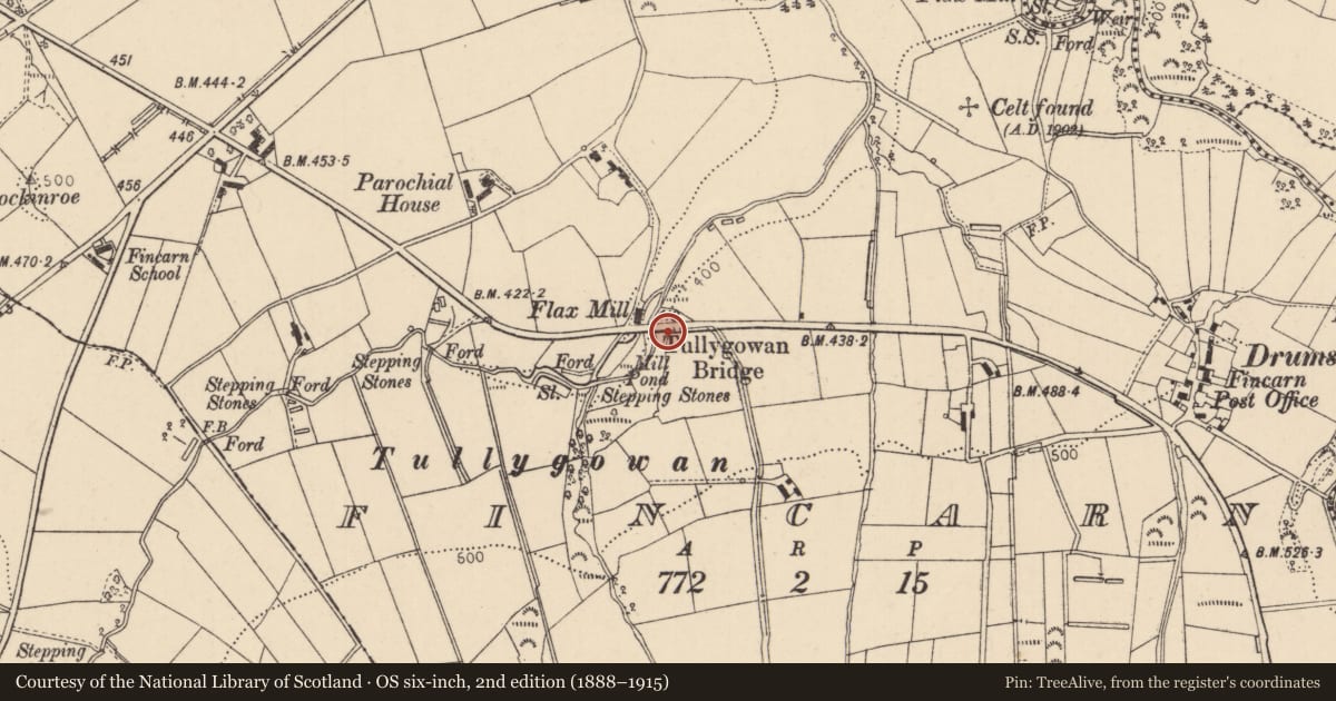
Slide toward Today to fade the historical sheet and see the modern map underneath.
David Rumsey Map Collection, Stanford LibrariesDavid Rumsey Map Collection, Stanford LibrariesDavid Rumsey Map Collection, Stanford Libraries
3 historical maps cover this location, the earliest the 1854 map "Ireland." (David Rumsey Map Collection, Stanford Libraries).
Historical maps covering this location
- 1854 · Ireland. (David Rumsey Map Collection, Stanford Libraries)
- 1857 · Ireland (David Rumsey Map Collection, Stanford Libraries)
- 1869 · Ireland. (David Rumsey Map Collection, Stanford Libraries)
The Department's description
Exterior description and setting
A single arch stone road bridge.
A single arch stone bridge on the Glenedra Road over the Clogherna burn. Built of sandstone in random rubble stonework. Upstream and downstream overgrown making an inspection impossible. Good parapet wall with piers at each end and with sandstone coping.
Historical information
Probably built in 2nd half of 19th cent. replacing a former bridge.
I H R No. 1974
References
Primary Sources
1. O.S. Map 1830 Londonderry sh. 30
2. O.S. Map 1830 Rev. 1905 Londonderry sh. 30
Criteria for listing: architectural interest
Not listed
Criteria for listing: historic interest
Not listed
Evaluation
A later 19th cent. sandstone road bridge over the Colgherna burn. Sturdily built and adds interest to this stretch of Glenedra Road.
Nearby in the register
- Standing Stoneunder 1 mi
- 48 Glenedra RoadHouseunder 1 mi
- Fincarn BridgeBridgeunder 1 mi
- Grotto HallStoreunder 1 mi
Other entries of the same register within about three miles of this one, by straight line.