Historic Buildings Record · Northern Ireland
Pair of Houses at Kilcattan Bridge
Derry City and Strabane, Northern Ireland
The record
- Designation
- Record only (not listed)
- Grade
- Record Only
- Type
- No type recorded
- Address
- Pair of Houses at Kilcattan Bridge, Glenshane Road, Kilcattan TD, County Londonderry, BT47
- Council
- Derry City and Strabane
- Country
- Northern Ireland
- Coordinates
- 54.92257, -7.18679
- Date of survey
- 19 February 2014
- HB reference
- HB01/02/009
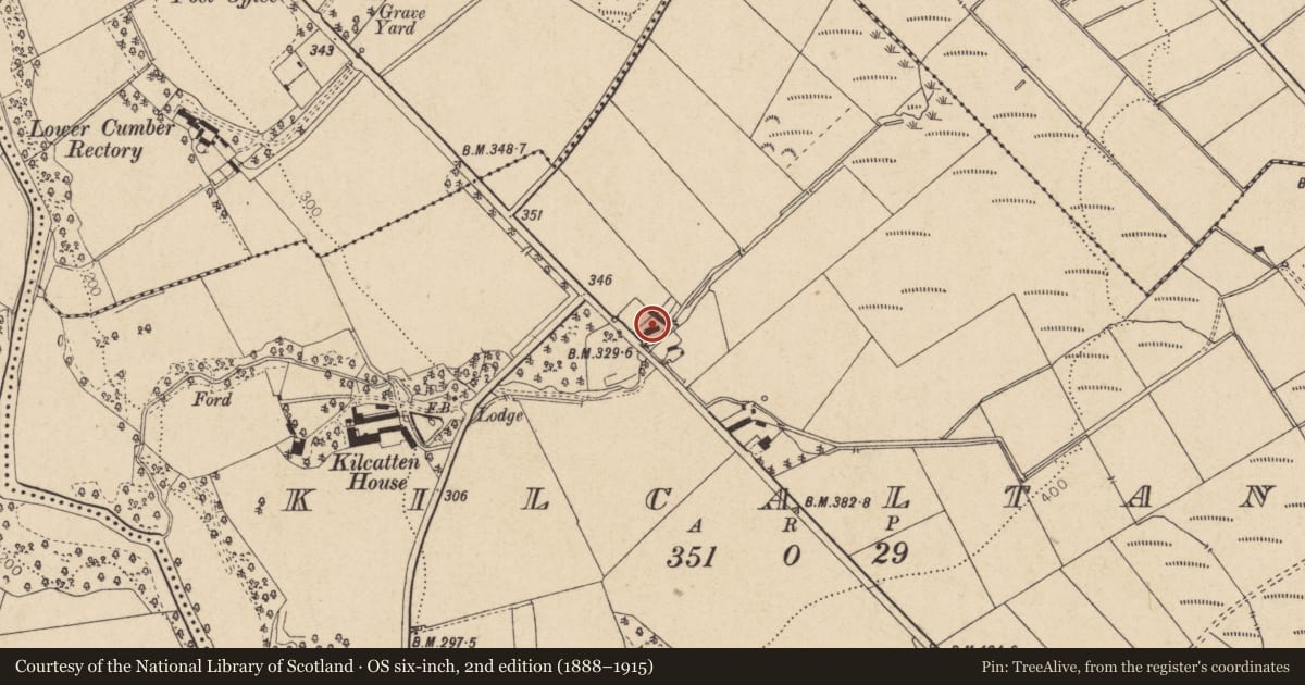
Slide toward Today to fade the historical sheet and see the modern map underneath.
David Rumsey Map Collection, Stanford LibrariesDavid Rumsey Map Collection, Stanford LibrariesDavid Rumsey Map Collection, Stanford LibrariesDavid Rumsey Map Collection, Stanford Libraries
4 historical maps cover this location, the earliest the 1869 map "Ireland." (David Rumsey Map Collection, Stanford Libraries).
Historical maps covering this location
- 1869 · Ireland. (David Rumsey Map Collection, Stanford Libraries)
- 1881 · Ireland to Illustrate the Military Condition of the Country. (David Rumsey Map Collection, Stanford Libraries)
- 1891 · Ireland 16 (David Rumsey Map Collection, Stanford Libraries)
- 1900 · Ireland (David Rumsey Map Collection, Stanford Libraries)
The Department's description
Exterior description and setting
A former pair of two-storey harled houses, now demolished to rubble.
The First Survey card records:
A pair of two-storey harled and coloured houses with slated roofs and yellow brick chimneys. Entrance doors are sheeted, that to west is flanked by a nine-pane sashed window and (?) side, that to east by modern windows. All upper windows but one retain Georgian glazing.
Date of visit: 22.05.1972
Historical information
N/A
Criteria for listing: architectural interest
Not listed
Criteria for listing: historic interest
Not listed
Evaluation
A former pair of two-storey harled houses, now demolished to rubble.
General comments
Partial Survey Only - A pair of former two-storey harled houses now demolished to rubble.
Nearby in the register
- KILCATTEN HOUSEHOUSEunder 1 mi
- Holy Trinity ChurchChurchunder 1 mi
- Orange HallNo type recordedunder 1 mi
- 54 Ardground RoadHouseunder 1 mi
Other entries of the same register within about three miles of this one, by straight line.