Sites and Monuments Record · Ireland
Windmill
Ballysheen (Forth By., Lady's Island ED), County Wexford, Ireland
The record
- Townland
- Ballysheen (Forth By., Lady's Island ED)
- County
- Wexford
- Country
- Ireland
- First-edition OS map
- Wind Mill
- Latest-edition OS map
- Windmill (Corn) (in Ruins)
- Coordinates
- 52.19951, -6.37385
- SMR number
- WX053-080----
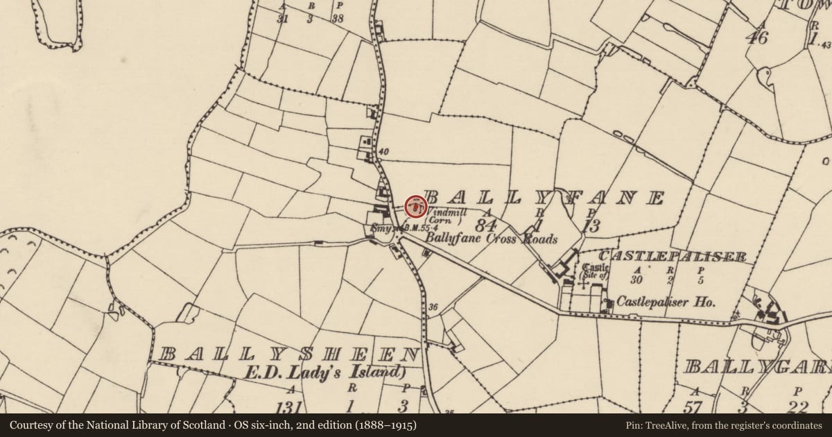
Slide toward Today to fade the historical sheet and see the modern map underneath.
David Rumsey Map Collection, Stanford LibrariesUniversity Library, Vrije Universiteit AmsterdamDavid Rumsey Map Collection, Stanford LibrariesDavid Rumsey Map Collection, Stanford Libraries
4 historical maps cover this location, the earliest the 1790 map "Composite: Ireland." (David Rumsey Map Collection, Stanford Libraries).
Historical maps covering this location
- 1790 · Composite: Ireland. (David Rumsey Map Collection, Stanford Libraries)
- 1811 · Ireland. (David Rumsey Map Collection, Stanford Libraries)
- 1891 · Ireland 16 (David Rumsey Map Collection, Stanford Libraries)
- 1911 · Sheet 14, 1911 (University Library, Vrije Universiteit Amsterdam)
This record in the National Monuments Service's Historic Environment Viewer ↗
The National Monuments Service's description
Situated on top of a low hill. A ‘mol’molendinar’ or windmill was owned by James Codd of Ballyumphane (WX053-023----) at this death in 1635 (pers. Comm. Conchubhar Ó Crualaoich 21/10/2020, see logainm.ie #54184). A circular structure is marked on the 1839 ed. of the OS 6-inch map where it is described in italic lettering as a Wind Mill. This is a tapering tower of three storeys with a fourth added when it was adapted as a residence, and it is doubtful if any of the original mill is incorporated in this structure. Some of the iron machinery from this mill was transferred to Tacumshin windmill (WX053-006----) at Fence c. 1930, and two millstones from the Ballysheen mill were kept at Enniscorthy Castle (WX020-031003-).
The above description is derived from the published 'Archaeological Inventory of County Wexford' (Dublin: Stationery Office, 1996). In certain instances the entries have been revised and updated in the light of recent research.
Compiled by: Michael Moore
Date of upload: 21 March, 2014
Amended: 21 October 2020
Nearby in the register
- Ringfort - rathunder 1 mi
- Ringfort - rathunder 1 mi
- Castle - unclassifiedunder 1 mi
- Ringfort - rathunder 1 mi
Other entries of the same register within about three miles of this one, by straight line.