Sites and Monuments Record · Ireland
House - medieval
St. Vogue'S, County Wexford, Ireland
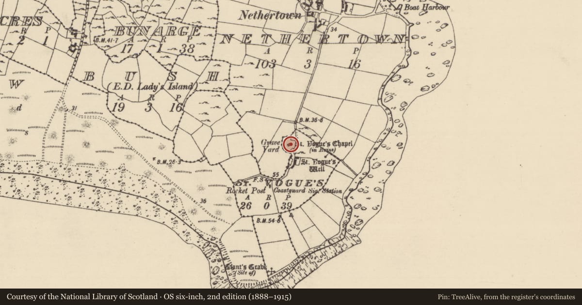
The record
- Townland
- St. Vogue'S
- County
- Wexford
- Country
- Ireland
- First-edition OS map
- Not idicateed
- Latest-edition OS map
- Not indicated
- Coordinates
- 52.17702, -6.36244
- SMR number
- WX053-035007-
Slide toward Today to fade the historical sheet and see the modern map underneath.
David Rumsey Map Collection, Stanford LibrariesDavid Rumsey Map Collection, Stanford LibrariesDavid Rumsey Map Collection, Stanford LibrariesDavid Rumsey Map Collection, Stanford Libraries
4 historical maps cover this location, the earliest the 1790 map "Composite: Ireland." (David Rumsey Map Collection, Stanford Libraries).
Historical maps covering this location
- 1790 · Composite: Ireland. (David Rumsey Map Collection, Stanford Libraries)
- 1811 · Ireland. (David Rumsey Map Collection, Stanford Libraries)
- 1841 · Ireland. (David Rumsey Map Collection, Stanford Libraries)
- 1891 · Ireland 16 (David Rumsey Map Collection, Stanford Libraries)
This record in the National Monuments Service's Historic Environment Viewer ↗
The National Monuments Service's description
Situated at the crest of a NE-facing slope and c. 4m SE of St. Vogue's church (WX053-025002-) within the enclosure (WX053-035003-). Excavation (E000143) revealed a rectangular house (ext. dims 5.4m N-S; 4.5m E-W; int. dims 4.8m N-S; 3.3m E-W) defined by the remains of double-faced stone walls (Wth 0.5-1m) that were probably clay-built above the foundations, but its S end is truncated by a later E-W wall. An entrance at E is suggested by additional paving in this area and the recovery of a spud-stone, but there is no evidence of a hearth. The house is associated with fragments of walls sub-dividing the interior of the enclosure. The ceramics associated with this house suggest a later medieval date and they were recovered in deposits with a large content of limpet and periwinkle shells (O’Kelly et al. 1975, 30-4).
Compiled by: Michael Moore
Date of upload: 9 April, 2014
References
O'Kelly, M.J., Lynch, A. and Cahill, M. 1975 Archaeological survey and excavation of St Vogue's church, enclosure and other monuments at Carnsore, Co. Wexford. Unpublished report, Dept. of Archaeology, University College Cork.
Nearby in the register
- Hut siteunder 1 mi
- Churchunder 1 mi
- Ecclesiastical enclosureunder 1 mi
- Graveyardunder 1 mi
Other entries of the same register within about three miles of this one, by straight line.