Sites and Monuments Record · Ireland
Excavation - miscellaneous
Tomhaggard, County Wexford, Ireland
The record
- Townland
- Tomhaggard
- County
- Wexford
- Country
- Ireland
- First-edition OS map
- Not indicated
- Latest-edition OS map
- Not indicated
- Coordinates
- 52.21443, -6.49463
- SMR number
- WX047-158----
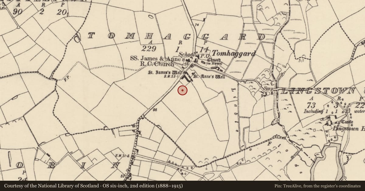
Slide toward Today to fade the historical sheet and see the modern map underneath.
David Rumsey Map Collection, Stanford LibrariesUniversity Library, Vrije Universiteit AmsterdamDavid Rumsey Map Collection, Stanford LibrariesUniversity Library, Vrije Universiteit Amsterdam
4 historical maps cover this location, the earliest the 1790 map "Composite: Ireland." (David Rumsey Map Collection, Stanford Libraries).
Historical maps covering this location
- 1790 · Composite: Ireland. (David Rumsey Map Collection, Stanford Libraries)
- 1891 · Ireland 16 (David Rumsey Map Collection, Stanford Libraries)
- 1904 · Sheet 14, 1904 (University Library, Vrije Universiteit Amsterdam)
- 1911 · Sheet 14, 1911 (University Library, Vrije Universiteit Amsterdam)
This record in the National Monuments Service's Historic Environment Viewer ↗
The National Monuments Service's description
Situated at the crest of a N-facing slope. Archaeological testing (04E0067) identified three small pits (diam. c. 0.2-0.5m), and a gully (Wth c. 1m; D 0.3m; exposed L c. 25m N-S) which produced a flint and has an entrance gap (Wth c. 9m). The archaeological features were preserved under the development (McLoughlin 2005). Tomhaggerd tower house (WX047-050002-) and mass-house (WX047-050001-) are c. 90m to the N. (McLoughlin 2004a, 2004b, 2007)
Compiled by: Michael Moore
Date of upload: 21 Octiber, 2013
References
McLoughlin, C. 2004b Archaeological monitoring, Tomhaggard, Co. Wexford. Licence No. 04E0067. Stafford McLaughlin Archaeology. Unpublished report, National Monuments Service, Department of Arts, Heritage and the Gaeltacht.
McLoughlin, C. 2007 Tomhaggard. Prehistoric? In I. Bennett (ed.), Excavations 2004: summary accounts of archaeological excavations in Ireland, 471, No. 1827. Dublin. Wordwell.
McLoughlin, C. 2004a. Archaeological testing, Tomhaggard, Co. Wexford. Licence No. 04E0067. Stafford McLoughlin Archaeology. Unpublished report, National Monuments Service, Department of Arts, Heritage and the Gaeltacht.
Nearby in the register
- Ritual site - holy wellunder 1 mi
- Mass-houseunder 1 mi
- Castle - tower houseunder 1 mi
- Ritual site - holy wellunder 1 mi
Other entries of the same register within about three miles of this one, by straight line.