Sites and Monuments Record · Ireland
Ritual site - holy well
Kilcavan (Retrenched), County Wexford, Ireland
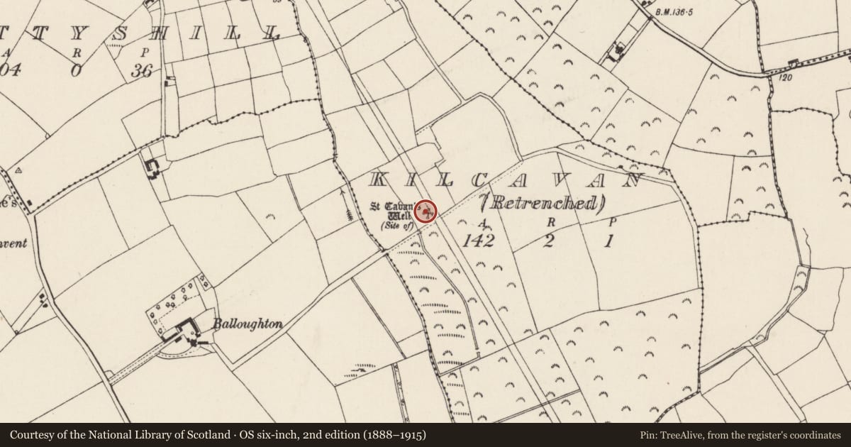
The record
- Townland
- Kilcavan (Retrenched)
- County
- Wexford
- Country
- Ireland
- First-edition OS map
- St. Cavans Well
- Latest-edition OS map
- St. Cavans Well (Site of)
- Coordinates
- 52.25648, -6.71369
- SMR number
- WX046-003----
Slide toward Today to fade the historical sheet and see the modern map underneath.
University Library, Vrije Universiteit AmsterdamUniversity Library, Vrije Universiteit AmsterdamDavid Rumsey Map Collection, Stanford LibrariesDavid Rumsey Map Collection, Stanford Libraries
4 historical maps cover this location, the earliest the 1790 map "Composite: Ireland." (David Rumsey Map Collection, Stanford Libraries).
Historical maps covering this location
- 1790 · Composite: Ireland. (David Rumsey Map Collection, Stanford Libraries)
- 1891 · Ireland 16 (David Rumsey Map Collection, Stanford Libraries)
- 1904 · Sheet 14, 1904 (University Library, Vrije Universiteit Amsterdam)
- 1911 · Sheet 14, 1911 (University Library, Vrije Universiteit Amsterdam)
This record in the National Monuments Service's Historic Environment Viewer ↗
The National Monuments Service's description
Situated in the broad valley of a small S-N stream that is c. 100m to the W, and just on the W side of the embankment of the NNW-SSE Waterford to Rosslare railway line. The well is dedicated to Saint Caomhán Santleathan of Ardcavan (WX038-006001-), and according to John O’Donovan writing c. 1840 the pattern was held on June 12th, the saint’s feastday (O’Flanagan 1933, vol. 2, 87). The well is a small D-shaped depression (dims c. 1m x c. 0.5m; D 0.2m) lined by white-painted stones on the NE side and approached by two steps from the NW. The well is within a rectangular enclosure (ext. dims 5.2m NE-SW; 6.6m NW-SE) defined by an earthen bank (Wth c. 0.5m; H 0.5m) and hedge at SW and SE and a drystone wall on the other sides, with a gate at NW leading directly to the steps of the well. The well is maintained and there is a statue of a mitred bishop within the enclosure, but there are no offerings.
Compiled by: Michael Moore
Date of upload: 20 August, 2013
Nearby in the register
- Graveyardunder 1 mi
- Churchunder 1 mi
- Kilnunder 1 mi
- House - 16th/17th centuryunder 1 mi
Other entries of the same register within about three miles of this one, by straight line.