Sites and Monuments Record · Ireland
Church
Ballylannan, County Wexford, Ireland
The record
- Townland
- Ballylannan
- County
- Wexford
- Country
- Ireland
- First-edition OS map
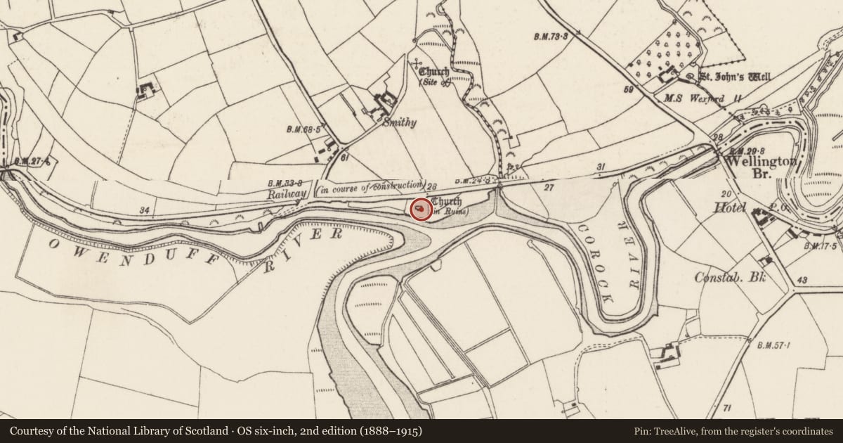
- Church (in ruins)
- Latest-edition OS map
- Church (in Ruins)
- Coordinates
- 52.26663, -6.76028
- SMR number
- WX045-013001-
Slide toward Today to fade the historical sheet and see the modern map underneath.
University Library, Vrije Universiteit AmsterdamUniversity Library, Vrije Universiteit AmsterdamDavid Rumsey Map Collection, Stanford LibrariesDavid Rumsey Map Collection, Stanford Libraries
4 historical maps cover this location, the earliest the 1790 map "Composite: Ireland." (David Rumsey Map Collection, Stanford Libraries).
Historical maps covering this location
- 1790 · Composite: Ireland. (David Rumsey Map Collection, Stanford Libraries)
- 1891 · Ireland 16 (David Rumsey Map Collection, Stanford Libraries)
- 1904 · Sheet 14, 1904 (University Library, Vrije Universiteit Amsterdam)
- 1911 · Sheet 14, 1911 (University Library, Vrije Universiteit Amsterdam)
This record in the National Monuments Service's Historic Environment Viewer ↗
The National Monuments Service's description
Situated on a bluff on the N bank of the W-E Owenduff river and the E-W Corock river, at the point where they join, which is immediately to the S. From here the combined river flows S past Clonmines on the W bank, c. 500m-1km to the S and into Bannow Bay. This is the parish church of Ballylannan within a rectangular graveyard (dims c. 45m E-W; c. 30-35m N-S) defined by masonry walls. The church is a rectangular structure (ext. dims. 13.9m E-W; 6.67m N-S; H c. 2.5m) that was adapted into a mausoleum for the Leigh family of Rosegarland in 1824 when the walls were consolidated and a tower with an entrance was attached to the S side. A pointed doorway and a small window, both in the N wall and both blocked, are the only original features. There is a small bullaun stone (dims 0.51m x 0.35m; H 0.23m) with a single large basin (dims c. 0.4m x 0.2m; D 8cm) in the graveyard.
The above description is derived from the published 'Archaeological Inventory of County Wexford' (Dublin: Stationery Office, 1996). In certain instances the entries have been revised and updated in the light of recent research.
Compiled by: Michael Moore
Date of upload/revision: 22 July 2013
Nearby in the register
- Graveyardunder 1 mi
- Bullaun stoneunder 1 mi
- Churchunder 1 mi
- Charcoal-making siteunder 1 mi
Other entries of the same register within about three miles of this one, by straight line.