Sites and Monuments Record · Ireland
Gatehouse
Clonmines, County Wexford, Ireland
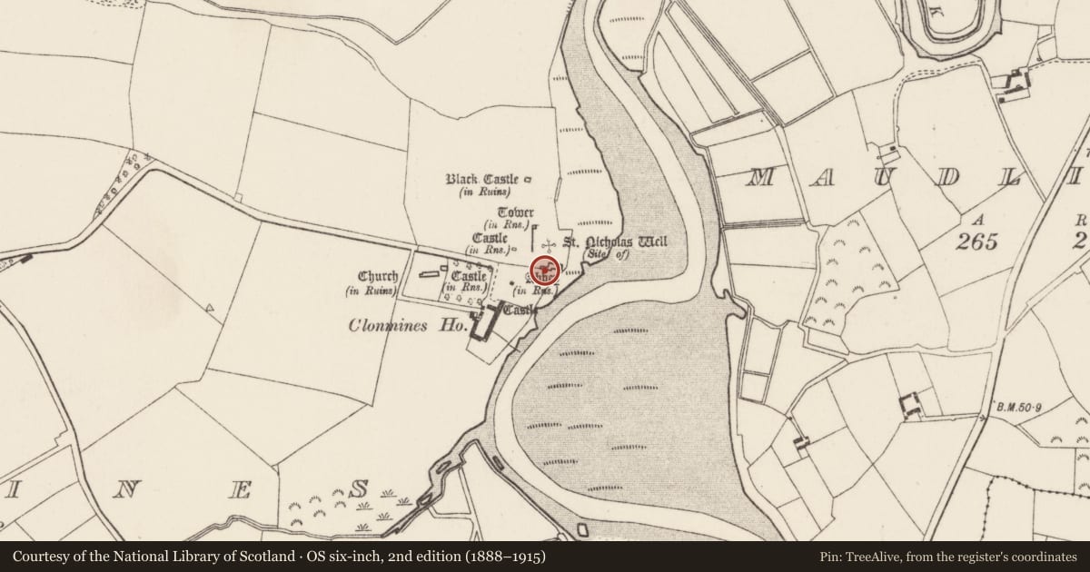
The record
- Townland
- Clonmines
- County
- Wexford
- Country
- Ireland
- First-edition OS map
- Not indicated
- Latest-edition OS map
- Not indicated
- Coordinates
- 52.26122, -6.76384
- SMR number
- WX045-012011-
Slide toward Today to fade the historical sheet and see the modern map underneath.
University Library, Vrije Universiteit AmsterdamUniversity Library, Vrije Universiteit AmsterdamDavid Rumsey Map Collection, Stanford LibrariesDavid Rumsey Map Collection, Stanford Libraries
4 historical maps cover this location, the earliest the 1790 map "Composite: Ireland." (David Rumsey Map Collection, Stanford Libraries).
Historical maps covering this location
- 1790 · Composite: Ireland. (David Rumsey Map Collection, Stanford Libraries)
- 1891 · Ireland 16 (David Rumsey Map Collection, Stanford Libraries)
- 1904 · Sheet 14, 1904 (University Library, Vrije Universiteit Amsterdam)
- 1911 · Sheet 14, 1911 (University Library, Vrije Universiteit Amsterdam)
This record in the National Monuments Service's Historic Environment Viewer ↗
The National Monuments Service's description
The principal entry to the enclosure or bawn (WX045-012002-) was by a gatehouse (ext. dims. 4.88m E-W; 4.4m N-S) on the S side attached to the W end of the nave of the Augustinian church (WX045-012003-). A pointed arch (Wth 1.73m; H 2.06m) with hinges for a two leaf gate and a slot in the roof for a portcullis leads to a barrel-vaulted entrance passage (Wth 2.1 m; L 4.05m). A destroyed doorway (Wth 1.16m) on the N side and a round-headed doorway of undressed voussoirs (Wth 0.75m) on the W side of the gatehouse lead to a newel stairs at the SW angle that rises to the first floor (int. dims. 4.44m E-W; 2.82m N-S). This room commands the portcullis and has a light in each wall except the E, which is the W wall of the S aisle of the church. The destroyed newel stairs continued to the second floor which was supported on corbels in the N and S walls and has a single light in each wall except the E. A possible doorway on the E wall at the second floor allowed access to the wall-walk of the S aisle of the church.
Compiled by: Michael Moore
Date of upload: 22 July, 2013
Nearby in the register
- Religious house - Augustinian friarsunder 1 mi
- Ritual site - holy wellunder 1 mi
- Bawnunder 1 mi
- House - 16th/17th centuryunder 1 mi
Other entries of the same register within about three miles of this one, by straight line.