Sites and Monuments Record · Ireland
Church
Taghmon, County Wexford, Ireland
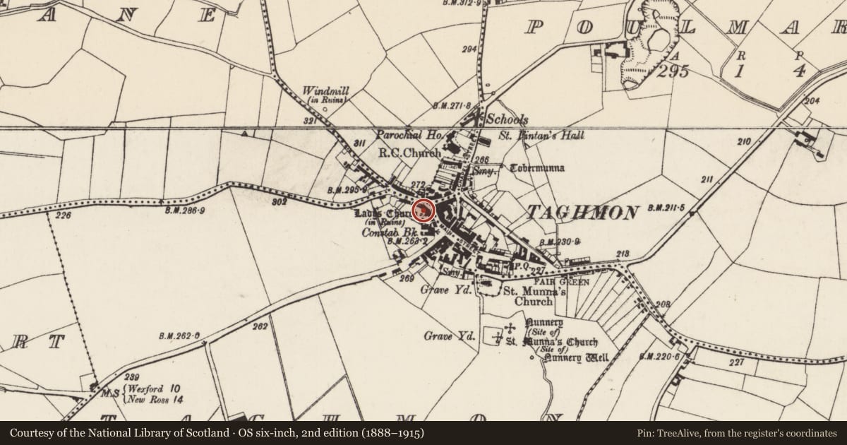
The record
- Townland
- Taghmon
- County
- Wexford
- Country
- Ireland
- First-edition OS map
- Ladys Ch.
- Latest-edition OS map
- Ladys Church (in Ruins)
- Coordinates
- 52.32331, -6.65553
- SMR number
- WX041-008007-
Slide toward Today to fade the historical sheet and see the modern map underneath.
University Library, Vrije Universiteit AmsterdamUniversity Library, Vrije Universiteit AmsterdamDavid Rumsey Map Collection, Stanford LibrariesDavid Rumsey Map Collection, Stanford Libraries
4 historical maps cover this location, the earliest the 1790 map "Composite: Ireland." (David Rumsey Map Collection, Stanford Libraries).
Historical maps covering this location
- 1790 · Composite: Ireland. (David Rumsey Map Collection, Stanford Libraries)
- 1891 · Ireland 16 (David Rumsey Map Collection, Stanford Libraries)
- 1904 · Sheet 14, 1904 (University Library, Vrije Universiteit Amsterdam)
- 1911 · Sheet 14, 1911 (University Library, Vrije Universiteit Amsterdam)
This record in the National Monuments Service's Historic Environment Viewer ↗
The National Monuments Service's description
Marked as a small rectangular structure (dims c. 15m E-W; c. 5m N-S) on the 1839 Ed. of the OS 6-inch map where it is described as Lady’s Church in gothic lettering. It is probably one of the two ruins of chapels mentioned by Robert Leigh in 1684 (Hore 1858-9, 463-4), and John O'Donovan writing c. 1840 described portion of the E gable as standing to a height of c. 2.5m (O'Flanagan 1933, vol. 2, 52). Today only a short length of ivy-covered wall (L 2.15m; H 2.35m) survives within a rectangular graveyard (dims 45m NW-SE; c. 25-30m NE-SW) defined by masonry walls. A granite grave-marker (Corlett 2010) in the graveyard has a solid ringed head, and is probably influenced by the only physical remnant of St. Munna’s monastery in the base and head of a granite high cross (WX041-008002-). Archaeological testing (93E0125) immediately SW of the graveyard produced no archaeological features (Wren 1994).
The above description is derived from the published 'Archaeological Inventory of County Wexford' (Dublin: Stationery Office, 1996). In certain instances the entries have been revised and updated in the light of recent research.
Compiled by: Michael Moore
Date of upload/revision: 20 March, 2013
References
Wren, J. 1994 Main St., Taghmon. Early Christain/Medieval in I. Bennett (1994) Excavations 1993: summary accounts of archeaological excavations in Ireland, 79-80, No. 225. Bray, Wordwell
Corlett, C. 2010 'The Taghmon Crosses, Co. Wexford'. In M. Davies, U. Mac Conville & G. Cooney (eds.), A grand gallimaufry collected in honour of Nick Maxwell, 237-42. Dublin. Wordwell.
Hore, H. F. 1858-9 A chorographic account of the southern part of the county of Wexford, written Anno 1684: by Robert Leigh, Esq., of Rosegarland, in that county. Journal of the Royal Society of Antiquaries of Ireland, vol. 5, 17-21, 451-67.
Nearby in the register
- Graveyardunder 1 mi
- Crossunder 1 mi
- Historic townunder 1 mi
- Field boundaryunder 1 mi
Other entries of the same register within about three miles of this one, by straight line.