Sites and Monuments Record · Ireland
Church
Ardcandrisk, County Wexford, Ireland
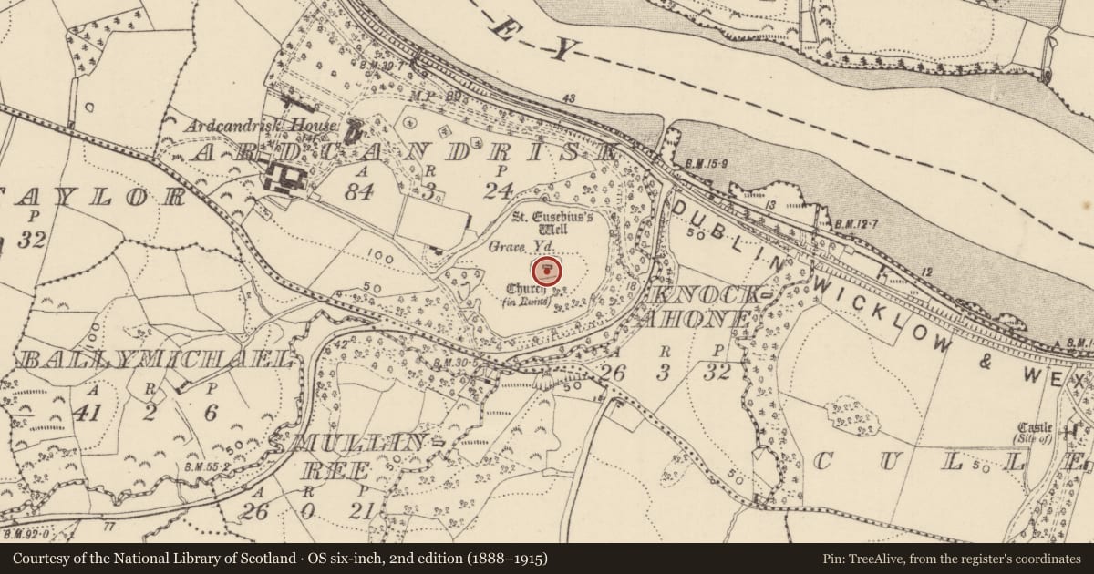
The record
- Townland
- Ardcandrisk
- County
- Wexford
- Country
- Ireland
- First-edition OS map
- Church (in ruins)
- Latest-edition OS map
- Castle (in Ruins)
- Coordinates
- 52.35096, -6.54000
- SMR number
- WX037-024001-
Slide toward Today to fade the historical sheet and see the modern map underneath.
University Library, Vrije Universiteit AmsterdamUniversity Library, Vrije Universiteit AmsterdamDavid Rumsey Map Collection, Stanford LibrariesDavid Rumsey Map Collection, Stanford Libraries
4 historical maps cover this location, the earliest the 1811 map "Ireland." (David Rumsey Map Collection, Stanford Libraries).
Historical maps covering this location
- 1811 · Ireland. (David Rumsey Map Collection, Stanford Libraries)
- 1891 · Ireland 16 (David Rumsey Map Collection, Stanford Libraries)
- 1904 · Sheet 14, 1904 (University Library, Vrije Universiteit Amsterdam)
- 1911 · Sheet 14, 1911 (University Library, Vrije Universiteit Amsterdam)
This record in the National Monuments Service's Historic Environment Viewer ↗
The National Monuments Service's description
Situated on a shelf towards the E end of a low E-W ridge. The parish church of Ardcandrisk is thought to have been founded by St. Mo Beoc of Ard Cainross (Culleton 1999, 128). According to a Visitation by Thomas Ram, the Protestant bishop of Ferns, in 1615 Robert Reyner was the vicar, and the church and chancel were in repair (Hore 1900-11, vol. 6, 270). The church is within a subrectangular, neglected graveyard (dims. c. 40-45m E-W; c. 30-35m N-S) defined by an earthen bank with external stone facing. The base of the nave (int. L at least 9.95m; int. Wth 4.6m) walls (Wth c. 1m; H 1m) with an entrance (Wth 1m) at S survives. The chancel is rebuilt (int. L 5.2m; int. Wth 4m) with masonry walls (Wth 0.55-0.75m; H 2m) perhaps as a mortuary chapel, with an entrance (Wth 1m) from the nave, S of the centre. A rectangular font (ext. dims 0.63m x 0.5m; int. dims 0.42m x 0.32m; H 32m) of conglomerate stone with a central drain-hole is in the nave. St Eusebius' Well (WX037-023----) is c. 100m to the N. Mound site (WX037-025----) is c. 40m to the S. The church is mis-named as a castle on the 1941 ed. of the OS 6-inch map.
The above description is derived from the published 'Archaeological Inventory of County Wexford' (Dublin: Stationery Office, 1996). In certain instances the entries have been revised and updated in the light of recent research.
Compiled by: Michael Moore
Date of upload/revision: 12 December, 2012
Amended: 4 Sep. 2013
References
Culleton, E. 1999 Celtic and Early Christian Wexford. Dublin: Four Courts Press, 1999.
Nearby in the register
- Graveyardunder 1 mi
- Fontunder 1 mi
- Moundunder 1 mi
- Ritual site - holy wellunder 1 mi
Other entries of the same register within about three miles of this one, by straight line.