Sites and Monuments Record · Ireland
Graveyard
Nash, County Wexford, Ireland
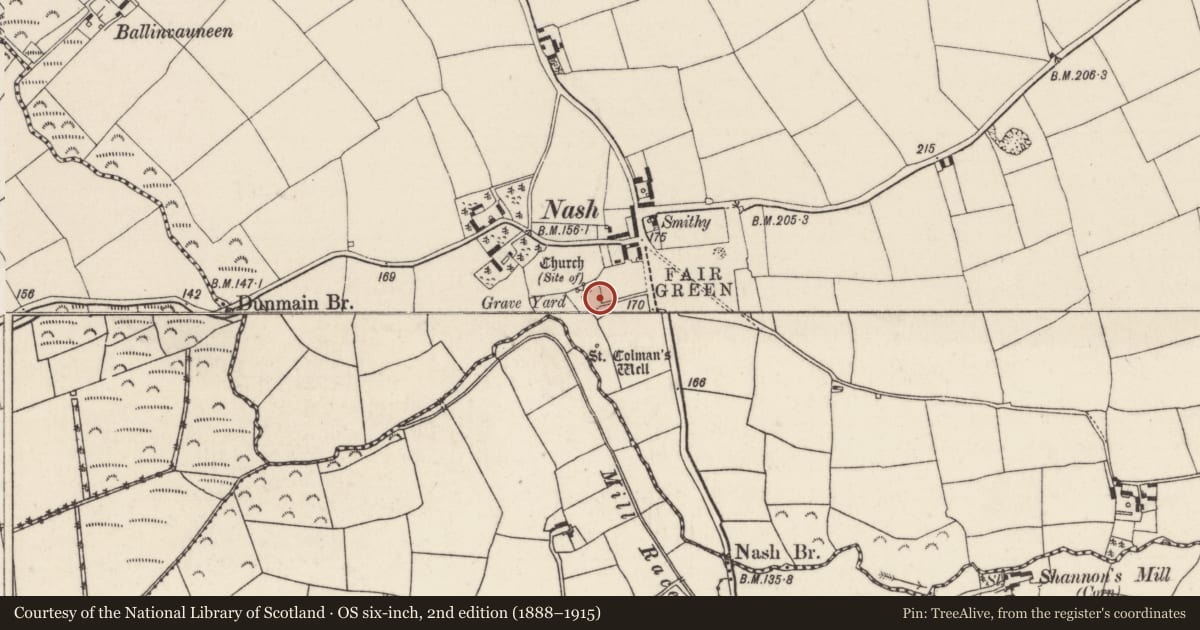
The record
- Townland
- Nash
- County
- Wexford
- Country
- Ireland
- First-edition OS map
- Grave Yd.
- Latest-edition OS map
- Grave Yd.
- Coordinates
- 52.32469, -6.86352
- SMR number
- WX035-049002-
Slide toward Today to fade the historical sheet and see the modern map underneath.
University Library, Vrije Universiteit AmsterdamUniversity Library, Vrije Universiteit AmsterdamDavid Rumsey Map Collection, Stanford LibrariesDavid Rumsey Map Collection, Stanford Libraries
4 historical maps cover this location, the earliest the 1790 map "Composite: Ireland." (David Rumsey Map Collection, Stanford Libraries).
Historical maps covering this location
- 1790 · Composite: Ireland. (David Rumsey Map Collection, Stanford Libraries)
- 1891 · Ireland 16 (David Rumsey Map Collection, Stanford Libraries)
- 1904 · Sheet 14, 1904 (University Library, Vrije Universiteit Amsterdam)
- 1911 · Sheet 14, 1911 (University Library, Vrije Universiteit Amsterdam)
This record in the National Monuments Service's Historic Environment Viewer ↗
The National Monuments Service's description
Situated on a gentle SW-facing slope at the point where the land falls away to the valley of a small SW-NE stream at the point where the stream turns SE. There is no visible traces at ground level of a church (WX035-049001-) within a rectangular graveyard (dims. c. 40m NW-SE; c. 30-45m NE-SW) defined by earthen banks and hedges apart from a cairn (dims. 7m x 3m; H 1m). The site of St Colman's Well (WX040-002----) is c. 40m S of the graveyard. Archaeological testing (13E0076) in the field immediately to the E identified many archaeological features including pits, gullies and ditches, and recovered pottery of a late 12th century or 13th century date. A ditch (Wth c. 2m; D 0.7m plus) c. 50m E of the graveyard and apparently centered on it could be an ecclesiastical enclosure.(McLoughlin 2013)
Compiled by: Michael Moore
Date of revised upload: 20 December, 2016
References
McLoughlin, C. 2013 Archaeological Assessment Report, Nash, Co. Wexford. Licence No. 13 E0076. Unpublished report. Stafford/McLoughlin Archaeology.
Nearby in the register
- Churchunder 1 mi
- Ritual site - holy wellunder 1 mi
- Ringfort - rathunder 1 mi
- Ringfort - rathunder 1 mi
Other entries of the same register within about three miles of this one, by straight line.